At Sea: We Need to Talk About Ashok

Those of you who know AdventureMan and I personally know that we are relentlessly self-reliant. With all our years of moving and living in a variety of countries, we have needed to be, but in truth, we are wired that way. You will laugh when I say I am uncomfortable even introducing this topic.
Our beautiful room comes with a butler.
It has been an awkward dance, but Ashok, our butler, is a pro at assessing people and working with their preferences. We don’t need a lot of service, and he has found ways to make himself useful to us anyway. Discovering I like Ginger Beer, he scoured the bars, alerted his contacts, and made sure our little refrigerator was well stocked with AdventureMan’s Coca Cola, and my Ginger Beer. He was always polite and pleasant.
The night we had decided to have dinner on the balcony after our day in Taormina and had saved parts of our sandwiches from lunch, we also found a generous tray of hors d’oeuvres waiting for us when we arrived late back to the ship. We had to admit, it was really nice, he had intuited well what we might like.
When we got tired of dressing for dinner and asked to have dinner in our room (part of the perks), he served us with elegance and grace, and made it so much fun that we indulged every few nights.
When AdventureMan wanted his laundry done professionally, Ashok made sure it came back very quickly.
In spite of our self-reliance, Ashok learned how to make himself invaluable to us. And, in truth, we really liked him, and loved our discussions with him. We were impressed with his resourcefulness, and his delight in making things happen. He seemed to delight in delighting us.

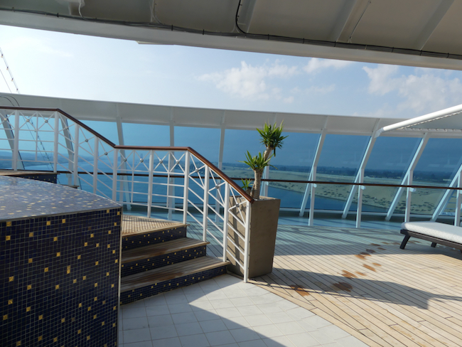
We are at sea for two days, en route from Messina to Haifa, Israel.
I was wide awake by five, so I got up quietly and dressed, grabbed my computer, found a cup of coffee at Barista’s, and headed up to Horizon’s, the forward observation lounge to check e-mails. Over 300 e-mails, horrors! I spent a while just deleting, then responding to the few requiring attention – requests from Air France for rating how I liked my flights, and a couple e-mails from friends. Most of the time, in this large lounge, it was just me and one or two others. I did get a nice photo of the sun coming up; it looks a lot like the day before.

When I headed back to our cabin, AdventureMan was just getting up, so we went together to breakfast where I am so delighted to find marinated herring and smoked salmon, two of my favorite things in the world. (It’s my Swedish blood talking.) AdventureMan finds herring abhorrent, and so does the Indonesian lady dishing it up; when I say a bright cheery “thank you!” her response was meant to be a smile, but it was a little twisted by disgust. I also had my virtuous oatmeal, with virtuous fresh blueberries – so much temptation, but my blood sugar is well within normal and I want to keep it there.

After breakfast I introduced AdventureMan to a new thrill – the spa pool at the front of the ship. It is just below the Horizons Lounge, and we had noticed that if you enter the pool by the stairs, you are visible to the people in the lounge. It doesn’t bother AdventureMan, but I figured out how to enter from the side, so as to remain unseen. The spa is very warm to hot, and can be made to bubble, so we had a wonderful twenty minutes in the hot tub in the fresh air, then we headed back to our room.

This early morning trip to the spa, having it all to ourselves, became another guilty pleasure. So lovely, so indulgent.
This quiet sea day, I napped a lot. I meant to read. I meant to update this journal. I napped. I don’t even feel guilty, it felt so good.
Our cabin as all shades of grayish green, sea colors. The walls look almost gray, but there are streaks of green in the wall paper. The upholstered headboard is a very pale shade of sea-green. The furniture and pillows a little bit darker shade of green, and the two pashmina throws to keep us warm are almost an exact match to the furniture. It’s all very soothing.
There is a little “couch,” really more of a love-seat, where I can fall asleep very easily.
Space is smartly allocated so that there is plenty of closet space, with doors that open so you can see everything, and enough hangers. (Enough hangers! I didn’t have to ask for more!) There are enough drawers to stow things in neatly. The bathroom has two upper-side cupboards, and two lower cupboards with shelves, too. There is more cupboard space in the bathroom than we need; we can keep everything in cupboards, out of sight. (This is a first.)
The ship is very silent. We don’t hear the motors, or the anchors dropping or lifting. We feel little sways and jerks now and then. At one point the weather changed briefly, we had rain. At night the ship swayed enough to cause some to have problems with balance, but it wasn’t much. We can feel the boat rock side to side, just a little, now and then. It is like being a baby again, held against your Mama as she walks about, feeling safe and secure. I napped a lot.
Dinner this night at sea was an Italian Market special, and we ate once again in the casual restaurant but dressed up a little. As it was a little cold and windy, we ate inside instead of at our usual table on the back terrace. It was one of my favorite meals – grilled Italian vegetables (mostly eggplant and peppers) and a big bowl of an Italian kind of Bouillabaisse, a fish stew, and it was wonderful.
In the restaurant, I could overhear a conversation I longed to join, two tables away, about Amor Towles and A Gentleman in Moscow. I tried to see who the people were, an assortment of six, but I am not sure I would recognize them again. Another woman, seated nearby, was very blonde with a bright red pashmina wrapped around her shoulders – I’ve always envied that drama, and know it isn’t really my style.
Even though I napped a lot during the day, I slept well this night for the first time since Barcelona.
We slept fairly well through the night, awakening around five but getting back to sleep again for another day at sea. Nice breakfast on the Terrace (my virtuous oatmeal, this time with fresh raspberries), followed by another early visit to the spa, where at that early hour, we have it all to ourselves. We were out in time to get ready for the Veteran’s Day/ Remembrance Day Ceremony at 9:15 in the Nautica Lounge. It was simple, short and sweet.
We were back at the Nautica Lounge just a short while later for another enrichment lecture on the Knights Hospitaler and Knights Templar, which helps put everything in context for our upcoming trip to Acre while we stop in Haifa.
We nap and read through the quiet afternoon as we pass south of Crete and Greece, never seeing a speck of land. Tonight is dinner at Toscana, the ship’s specialty Italian restaurant; we have dinner reservations at seven. We know a waiter who works there, Buti, and he has been waiting for us to come see him.
The problem, for us, is that by late afternoon we are already closing down. We’ve always been this way, but when we were younger, we really didn’t know it. We dress, I wear the one little black dress I have brought for special evenings, with a red scarf, my own toast to a little drama. When we get to Toscana, there is a line, the restaurant isn’t open yet so we go into the library. Shortly, the Jewish Shabbat began, and we left to give them privacy, got in the line, and very shortly got in and asked to be seated in Buti’s section.
Buti treated us like gold. We felt so special. When I ordered, he insisted I add a small dish of pasta, angel hair aglio oglio, and when he brought it, it was perfect. He also brought a small bowl of sambol oelek sauce, which I know from Kuwait and Qatar, spicy hot peppers in a little vinegar, absolutely divine. I also had Veal Marsala, and AdventureMan had a Caprese Salad and Linguini Cioppiono. Altogether, it was a lovely meal. All around us people were laughing and talking, a single man at the next table was reading Saul Bellow, and as nice as it all was, it was slowly elegant and we got restless. We skipped dessert, which is a really good thing, because my blood sugar was 123 the next day, which gave me a good wake-up call.
I loved the sambol oelek, and I loved the angel hair pasta. It’s hard for me to be gracious after five at night. When we got home, we were exhausted. Everyone is so kind, wanting to make us feel so special, and I just feel tired and happy to be back in my room getting ready for bed.
AirTag Headed Up the Amazon

I know. I apologize. I promised you Barcelona to Abu Dhabi and I have yet to get my act in order. I haven’t reviewed my journal entries. I haven’t sorted through my photos. I admit it, I am too relaxed, too focused on the present moment. I intend to write about the trip and to take you with me. I am working my way through the to-do list that impedes my progress. The trip is my carrot, and I am having trouble getting to the carrot.
Meanwhile, my carefree little AirTag is having a ball. Toured the Caribbean, many islands, places I have never been. Yet. Now that my AirTag has been there, I am intrigued.
Today, oooh la la, my AirTag heads up the Amazon river!
The Great Sea Voyage: Barcelona to Abu Dhabi
So, my friends, I promised you a new trip, and I apologize for making you wait. We got back just in time to step back into our normal Pensacola routines and then to whirl into the celebrations of Christmas. I like to plan, I like to execute, and I like to give myself time to process. It’s time to begin.

We chose this trip three years ago. We loved the destinations, and we loved the idea of this journey, especially going through the Suez Canal. We love the idea of visiting new places, and we loved the opportunity to revisit some old favorites, especially Wadi Rum, in Jordan, where we lived in another life.
The trip itself took three weeks. We went early to Barcelona. I had been to Barcelona for an international quilt show years ago and loved it; I’ve been so eager for AdventureMan to experience the aliveness of Barcelona. We chose to go a few days early to enjoy the city.
We were traveling with Oceania, a line we haven’t sailed with before. People handle air reservations differently; we choose to let the cruise line set up the travel so that if there are changes (and in the last three years we saw lots of changes) the cruise line is ultimately responsible for getting us where we need to go.
It’s tough giving up our autonomy. This time, it was a struggle, and we finally paid extra for “custom” reservations when they kept offering us bizarre routes we didn’t want to take. At one point, we had reservations that were direct, and we liked, and then they changed, again, because of an airline time change, and we found the new ones unacceptable. At some point, we gave up. We accepted a bizarre routing and the fact that we were responsible for getting ourselves to Atlanta and back, not such a big deal, except for when things change. Right?
This is how we were routed to Barcelona: (Pensacola) – Atlanta – Detroit – Paris – Barcelona.
And here are the bags I took, except at the last minute I took everything out of the backpack and put it in a duffel, not much bigger but the space was more flexible.

We decided to go minimal and to carry everything with us. It caused a lot of agonizing, but in the end, I had everything I needed. It was enough. I think carry-on is a great idea, except it is such a hassle, I like the luxury of checking a bag and carrying a purse and a book. Having had bags go missing so many times in my life (they always caught up with us – eventually), we opted for this illusion of control.
Our first travel day was, in almost every way, a breeze. Our son picked us up on his way to work and dropped us at the airport, giving us time for a leisurely breakfast after an uneventful check-in. The flight schedule was eccentric, even convoluted, but every flight left on time and came in minutes early. Our last two flights of the day were with Air France and were delightful.
Getting to Barcelona took almost two days. We flew from Pensacola to Atlanta on our dime and picked up our cruise-related reservations in Atlanta. We checked in and had time for lunch at PF Changs. Out of Atlanta, we flew to Detroit – I’d never been to Detroit before. I had never seen a Great Lake in person. I was blown away by the vastness of Lake Erie and Lake Superior – so HUGE. I thought of Detroit and its terrible water problem and crumbling infrastructure, surrounded by water, and it seemed so infinitely sad.
Our flight out of Detroit was an Air France flight – we love Air France. Once we board an Air France, the vacation begins – they take such good of their passengers.
We had a late dinner on board; Air France does a really cool thing. They serve an appetizer course, an entree, a dessert, and drinks. They also have an express meal which is just the appetizer, bread (with French butter, better than butter I have had anywhere else), and desserts, and the dessert course features really tiny tastes. We chose the express, and then curled up and went to sleep.
I usually sleep badly on planes, but on this flight, it was all grown-ups and somehow it was mostly very quiet. I remember vaguely hearing a bell once when the air got a little turbulent, but it only awakened me slightly and I went back to sleep. My quick breakfast was yogurt and fruit and coffee, and boom, we were at Charles de Gaulle.
Big difference from prior times. While we love Air France, we always dreaded the bag drag through CdG. In years past, there were crowds pushing and snaking for hours, people pushing in line, people crying that they were going to miss their flight – it was a kind of purgatory for travelers. This time, however, it was streamlined, a piece of cake. We had a close connection, which we made with time to spare.
On the flight to Barcelona, we had a snack meal, and AdventureMan had wine, I had coffee. I asked for more, and Sophia, our flight attendant said “Oh, you like my coffee?” and I said “yes!” because it was really good. Then AdventureMan said “And I really like this wine” and she brought him a small bottle of white wine to take with him, then turned to me and said “And which wine would you like? White? Red?” and I chose a red Bordeaux, the start of our cabin collection since we don’t buy the ships drink package, but pay as we go.
We found the Oceania representative waiting outside the immigration door, and very shortly, she had us taken to our hotel with Ingrid and Juanita, who had also been on our flight. We heard Ingrid speaking harshly to Juanita, and Ingrid caught our exchanged glance and said “Oh I’m just bossy. Juanita is 92 and I have to keep her organized.”
While Juanita was toting two large bags, she might have a hearing problem and might need Ingrid’s explanations and organizing. I was amazed at how strong Juanita was.
This is a longer trip than we usually take, with a variety of temperatures. I have a small carry-on suitcase and a small duffel. They were not stuffed. Our airports are huge, however, and when you have to tote two bags from gate to gate, even take trains or underground trams and still walk a long way, those bags can get heavy. I told AdventureMan that it is different when we go West and wear jeans and casual clothes all the time and no one cares, a cruise ship is a different situation. If our future is carry-on, we will need to go on shorter cruises.
The upside is you just whiz through customs – no waiting around at the baggage carousel. So I like the carry-on idea, I just don’t like the reality of toting bags.
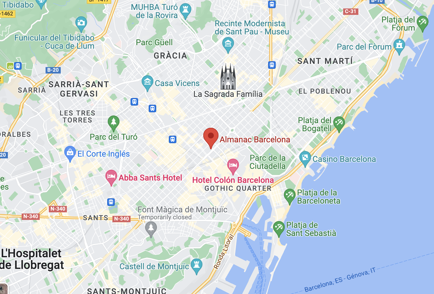
The limousine driver was kind and helpful and gave us lots of good information on the way to our hotel, the Hotel Barcelona Almanac.
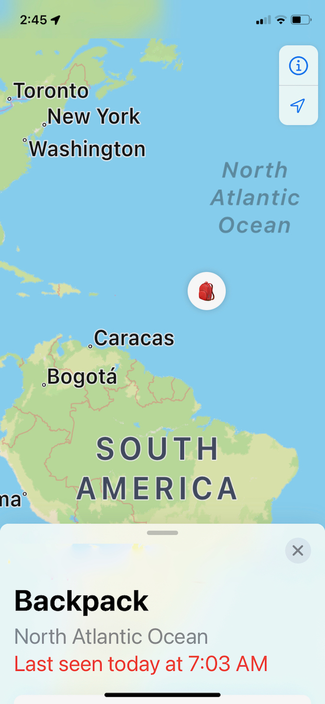
Errant AirTag Nearing South America
I love that as I age, I am learning skills I never dreamed I would have – or want! And yet, I am glad I have learned to live with mystery, with contradictions, with ambiguity and ambivalence.
I don’t know how my AirTag left my “backpack,” which is really my duffle. I know it happened in Barcelona. Maybe I dropped it? The duffle was taken from my room with my carry-on and taken to the port where it went through inspection all on its own. It then appeared miraculously in my room aboard the Nautica. I say miraculously, because I never take anything for granted. Yes, it was supposed to show up in my room.
No, I am not so trusting as to believe it will. I’ve been without baggage too many times. So, I am just thankful when things happen as promised, and I have clothing and shoes for the trip.
I’m so glad that it really doesn’t matter to me that much that the AirTag didn’t make it with me. Its purpose is to keep track of my bag, and as long as I have the bag, the important things are covered.
What a shock it was when I was in Montreal, checking on my carry-on, which had become a checked bag in Abu Dhabi, and discovered my AirTag from the duffle is still reporting to me. It made me laugh. And now, trip over, back to the routine life of Pensacola and the unsettled month of December, it gives me a small thrill every day that I check for its location and find it in a new spot.
I am living vicariously. Although I am not in motion (nomad that I am), a part connected to me is heading off into the unknown.
The Grapevine, TX location is a mystery. I’m inclined to think it is an anomaly of some kind, but I have no clue, truly, as to why I would have a brief report it was there, and then, a short while later, it is back on the ship. The mystery continues.
My Backpack Visits The Great Meteor Seamount

My little Air Tag reminds me of my days in the State Department. A friend would talk of “singing for our supper,” by which he meant our obligation to be entertaining and have a story or two to tell so people would always be glad they invited us.
My Air Tag, emancipated as it became, is certainly entertaining me, and, I hope, you. Do you have any clue what The Great Meteor Seamount is? I assumed it was the site of a fallen meteor, and evidently a huge one. Wrong. It is a sea mountain, yes, but one discovered by people on a ship called Meteor. Here is more information for you, if you, like me, like to go down a rabbit hole or two.
This is from Wickipedia:
Great Meteor Seamount
From Wikipedia, the free encyclopedia
Jump to navigationJump to search
| Great Meteor Seamount | |
|---|---|
| Great Meteor Seamount at the southern edge of the Atlantis-Meteor Seamount Complex | |
| Summit depth | 270 m (890 ft) |
| Height | 4,500 m (14,800 ft) |
| Summit area | 50×28 km² (1465 km²)[1] |
| Location | |
| Location | North Atlantic Ocean, 1,000 km (620 mi) south of the Azores |
| Coordinates |  29°57′10.6″N 28°35′31.3″WCoordinates: 29°57′10.6″N 28°35′31.3″W 29°57′10.6″N 28°35′31.3″WCoordinates: 29°57′10.6″N 28°35′31.3″W |
| Geology | |
| Type | Guyot |
| Volcanic arc/chain | Seewarte Seamounts |
| History | |
| Discovery date | 1938 |
| Discovered by | Meteor |
| Wikimedia | © OpenStreetMap | |
The Great Meteor Seamount, also called the Great Meteor Tablemount, is a guyot and the largest seamount in the North Atlantic with a volume of 24,000 km3 (5,800 cu mi). It is one of the Seewarte Seamounts, rooted on a large terrace located south of the Azores Plateau. The crust underlying Great Meteor has an age of 85 million years, deduced from the magnetic anomaly 34 (An34) at this location.[2]
The shallow and flat summit of the Great Meteor Seamount, ranging between 150 and 300 m (490 and 980 ft) below sea level, suggests that it may have emerged sometime in the past 30 million years.[3] It is covered by a 150 to 600 m (490 to 1,970 ft) thick layer of limestone, pyroclastic rocks and bioclastic sandstones.[4] Dredged basalts from the top of the eastern and southeastern flanks of the seamount have been K–Ar dated 10.7 ± 0.5 and 16.3 ± 0.4 million years old, respectively.[5] The oldest sample has been 40Ar/39Ar dated at 17 ± 0.3 million years old.[6]
Two small seamounts exist just southwest of Great Meteor and are encircled by the −3800 m bathymetric line. These are the Closs Seamount, roughly oriented NNE-SSW, with its peak at 1,400 m (4,600 ft) depth and covering an area of approximately 390 km2 (150 sq mi), and the Little Meteor Seamount, located NNE of Closs, with over 960 km2 (370 sq mi) and a flat top 400 m (1,300 ft) below sea level.
The German research vessel Meteor discovered the tablemount between 1925 and 1927. It was given the name Great Meteor Bank, a designation still used in the official GEBCO gazetteer.
Formation[edit]
The New England hotspot formed the White Mountains 124 to 100 million years ago when the North American continent was directly overhead. As the continent drifted to the west, the hotspot gradually moved offshore. On a southeasterly course, the hotspot formed Bear Seamount, the oldest in the chain, about 100 to 103 million years ago. Over the course of millions of years, it continued creating the rest of the seamounts, eventually culminating in the Nashville Seamount about 83 million years ago. As the Atlantic Ocean continued to spread, the hotspot eventually traveled further east, forming the Great Meteor Seamount where it is found today.[7] Radiometric dating of basalt from the Great Meteor Seamount has given ages of about 11 and 16 million years old, with the bulk of the seamount possibly having formed about 22 million years ago.[8]
Living Large off the Coast of Morocco

Although I am back in Pensacola, I get a thrill checking on the status of my missing Air Tag. Today we are off the coast of Morocco 🙂
My AirTag Has a Life of Its Own

For our recent trip, I bought four Apple AirTags and was amazed at how easy it was to use them. You just Google “How do I set up my Apple Air Tag?” and clear instructions appear. Some people have even done videos that show you exactly how to enable and disable your Air Tags.
So I set one up to be for my Carry-on, and another to use for my other carry-on, called Backpack, except that as I was packing I changed to a duffel, and didn’t change the name.
My duffel has four outside pockets and no inside pockets. I tucked the AirTag deep into one of the pockets and stopped thinking about it. Then it came time to leave our hotel and head for the ship, so I put both bags out to be transferred.
Since I pretty much always had them with me, I never bothered checking. Not until coming back, I checked one bag on our complicated route home, and when things got screwed up in Montreal, I checked my phone to find my CarryOn. It showed me exactly where it was, and it made the next flight with me.
But at the same time I was checking, I noticed an anomaly. My “backpack,” which was with me, was shown to be in the Gulf of Lion, close to Montpellier. How could this be? Sure enough, I have the duffel, but I do not have the AirTag. The AirTag is gone missing.
But someone has it.
Honestly, to me this is hilarious. First – I have all my baggage and its contents. That’s what matters. The only thing that is missing is the AirTag. Second – my AirTag is traveling, I am thinking on one of the Oceania ships, and I could probably find out which one if I wanted to spend the time finding out which ship is in what spot (there are apps, I have discovered, which can tell you – and show you – exactly where any ship is, how cool is that?) Meanwhile, every now and then I check to see where my old AirTag is now, and it is always in a different location. It’s kind of fun for me to see where it is.
Why would someone carry around someone else’s AirTag?
Yes, I am planning to tell you all about our trip. First, I have to get through the jet lag, get my life in order, get Christmas under control (ho ho ho), and process some of what I experienced. Narrative and photos coming soon. It was a GREAT adventure. 🙂
Chasing Petroglyphs: Needles Canyonland Overlook
I don’t know what I would do without Google Maps; I use them to plan trips, I use them to calculate time and distance, I use them to find exactly where to make my turn, etc. And now and then Google Maps gets eccentric on me.
On our last trip in France, driving from Domme to Salers, Google maps had us on treacherous mountain tracks that were single lane, and timber trucks were coming at us. At one point, Adventureman said “stick to the paper map and major roads, no matter what Google Maps says” and he was right.

This time, taking the road to Needles Overlook, the Google lady kept telling us we had arrived and to turn around, the road had ended, when we could see it, paved and smooth, right in front of us. Weird.
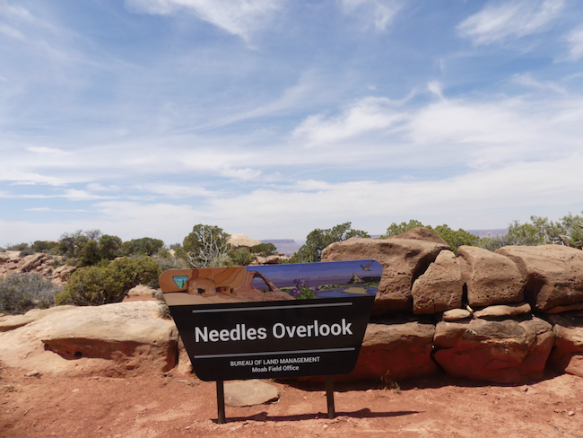
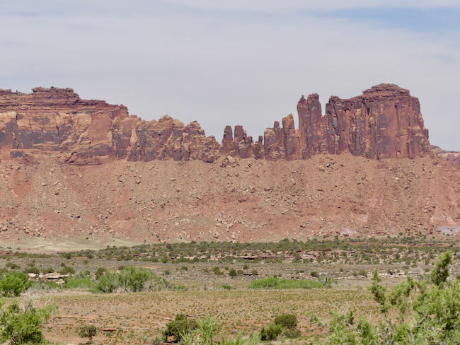
We were so glad we persisted. The Needles Overlook is one of the most spectacular viewpoints we have ever seen. All told, you can probably see nearly 300°; not from one point but by following the paths to the different viewpoints. Just when you think it can’t get any better, it does.


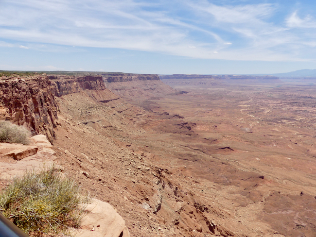
OK, this is indelicate, but travelers know, take advantage of every opportunity because you never know when the next opportunity will appear. I told AdventureMan I was going to check the convenience, and he said “I hope they have toilet paper” and when I got inside, I just laughed. I’ve never seen so much toilet paper in one loo.


Chasing Petroglyphs: Newspaper Rock, Needles and Canyonland
As AdventureMan reads through these posts, he delights in how much he has already forgotten, and he looks forward to reading about what he called “one of our light days.”
I look at him in astonishment. As occasionally happens, I remember things very differently,
“We got a relaxed start,” I begin, which in our language means we did not hit the road at the crack of dawn, but maybe around 0830, “but we were on the road until about 2:00! And it was some tough driving! No place to stop for lunch, we just had apples and oranges by the side of the road.” And water. Lots and lots of water. It was again in the 90’s, and very dry, and there are signs everywhere warning us to drink water.
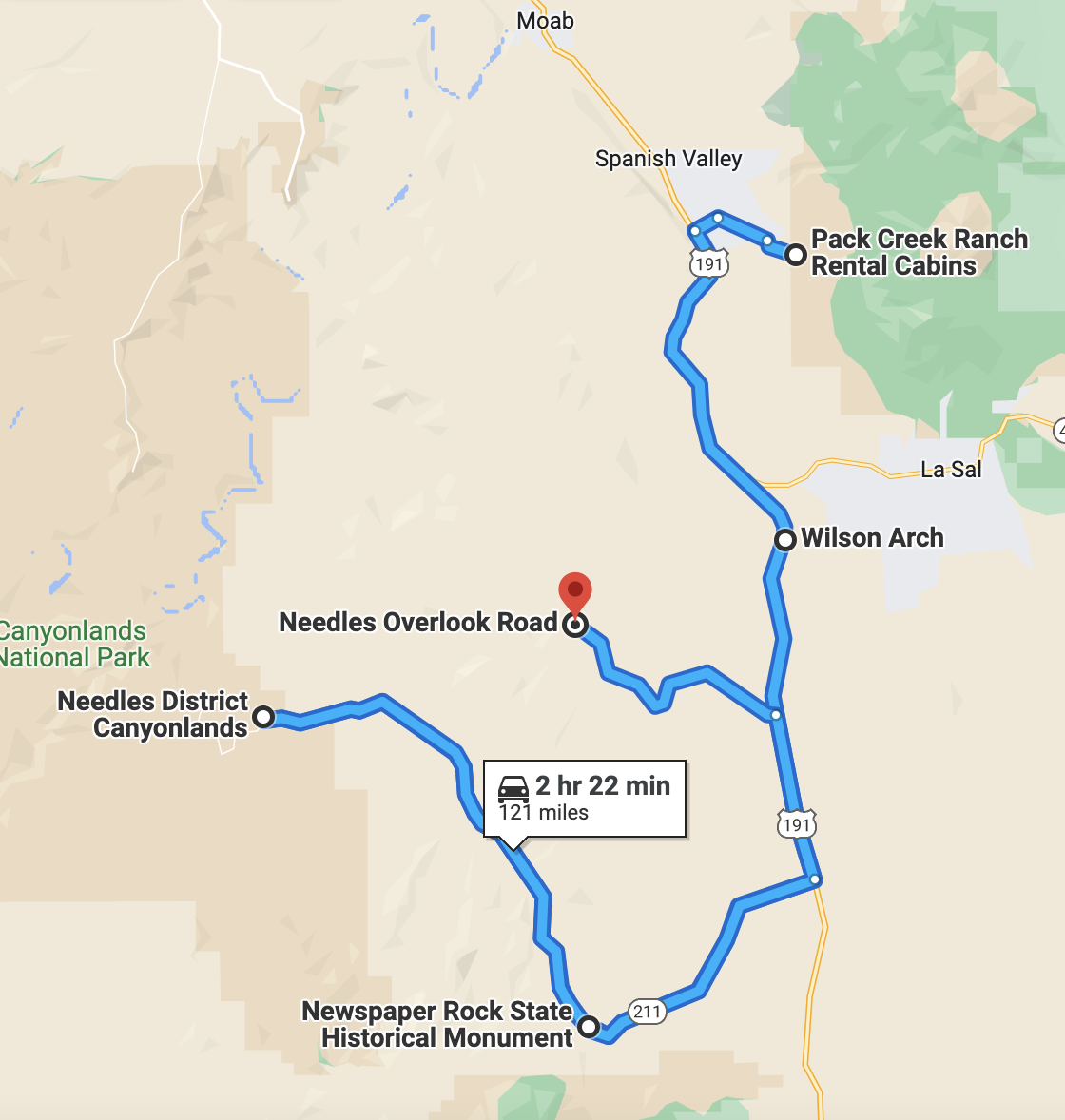
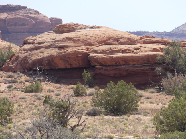
We don’t have to start from Moab, we just reach SR 191 and turn south. The first thing we come across is Wilson’s Arch:


And another place called Hole in the Wall, but I can’t tell if it is a famous Hole in the Wall or an adventure outfitting place. There is an ATV perched precariously on the top of the cliff.
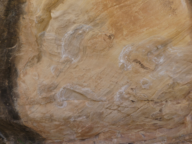
We turned off 191 to go to Canyonlands, and soon came to Newspaper Rock.

Early on, I mentioned how fragile and transient petroglyphs can be. We don’t really know who made them. We know that many of the earliest petroglyphs incised were written over, improved, by later early peoples. And then, modern day man, who had done the most damage of all – carving his initials over ancient glyphs, removing glyphs, defacing glyphs, rubbing glyphs (thus eroding their edges and making them more vulnerable to weathering elements), chalking glyphs to make them more visible, even touching glyphs leaves chemicals that damage the quality of the glyphs.
When we got to Newspaper Rock, we parked at the wrong end of the parking lot and ended up on a trail going entirely the wrong way. AdventureMan kept saying he thought we needed to go back, but the further along we got, the more I thought we were on the right track – until the track ended. We walked back, and just at the other end of the parking lot was the Newspaper Rock – near the road and protected by a large grill.
The thing is – I saw others, too, nearby. I am so thankful they protected Newspaper Rock, because through the years many of the incisions have been defaced. I am hoping that the others are being protected by the very lack of trails and signage, by the lack of publicity. It’s a pity we should have to protect the petroglyphs from our own citizens.


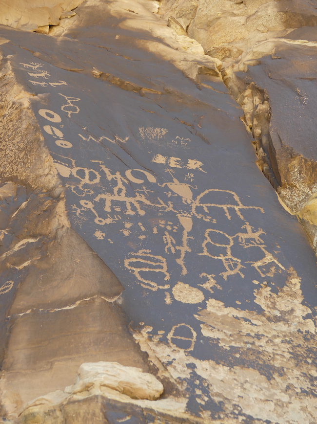
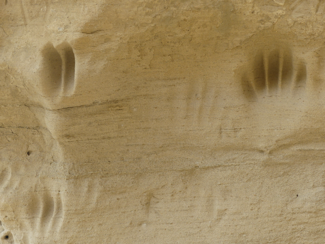
I think of Newspaper Rock as a kind of scratch pad. Even Leonardo da Vinci, the great inventor, engineer and artist, made sketches before he executed a masterpiece. I can see traces of the Fremont peoples, and I can see scraps of petroglyphs we have viewed in Vernal.

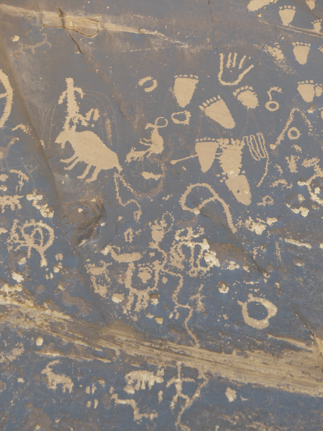
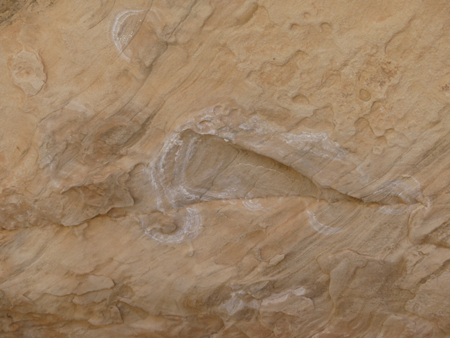
AdventureMan found Newspaper Rock a very emotional experience. He felt connected to these early people. When I look at these footprints of all sizes dancing around, I feel their joy. And look at the hand – that is almost modern in it’s representation of a human hand; and I think back to the petroglyphs at White Mountain which may have represented the human hand or may have represented the terror of a bear claw. These feet are so happy, and, interestingly, so similar in form. I wonder how they were formed?
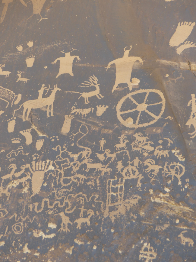

I’ve broken the wall into different panels with photographs; taken in total, it is overwhelming.


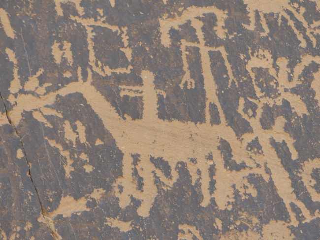
Much more modern era; we see horses introduced

Those lines – snakes? Rivers? Directions? A life?

I would guess this central figure is a shaman, with what coming off his headdress? Some kind of special decoration on his legs? The target symbol, as opposed to the spiral? The smaller horned man? All those animals – prayers for a good hunt? Celebration of a good hunt?

This one intrigues me – a scorpion? It is just weird!

A dancing bison? Look at the feet and . . . um . . . feet; they are very hoof like. An elk with a magnificent rack and maybe a spear in it’s side?

These last two are not with the others. I believe some well-meaning guide has chalked them so that visitors can see the faint traces.

And this is what the Newspaper Rock looks like in total.

We were no longer alone. Visitors from all over the world were coming, looking and photographing.
We drove to the end of the drivable-without-dire-warnings road. The scenery was increasingly arid and bleak, with it’s own terrible beauty. At one point, we were about to hike out to an old dwelling cave, and we looked at each other. It was noon, and signs everywhere were saying “do not hike in the hottest hours” and it was HOT. We drank some water, ate some oranges, got back in the car, reluctant to pass on an adventure, but happy to pass on potential disaster.

There was actually a ranch out here, and this was the last water we saw. It’s still Spring.


Just a half mile there, and a half mile back . . . we passed.
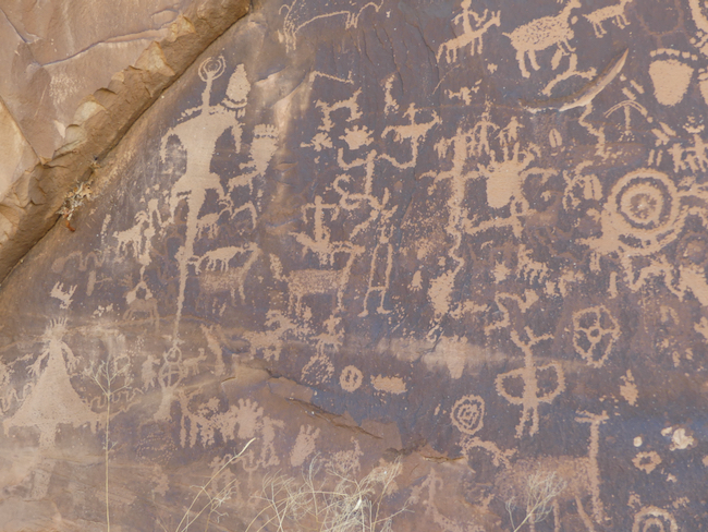
Chasing Petroglyphs: White Mountain, Eden and the Pilot Butte Ponies
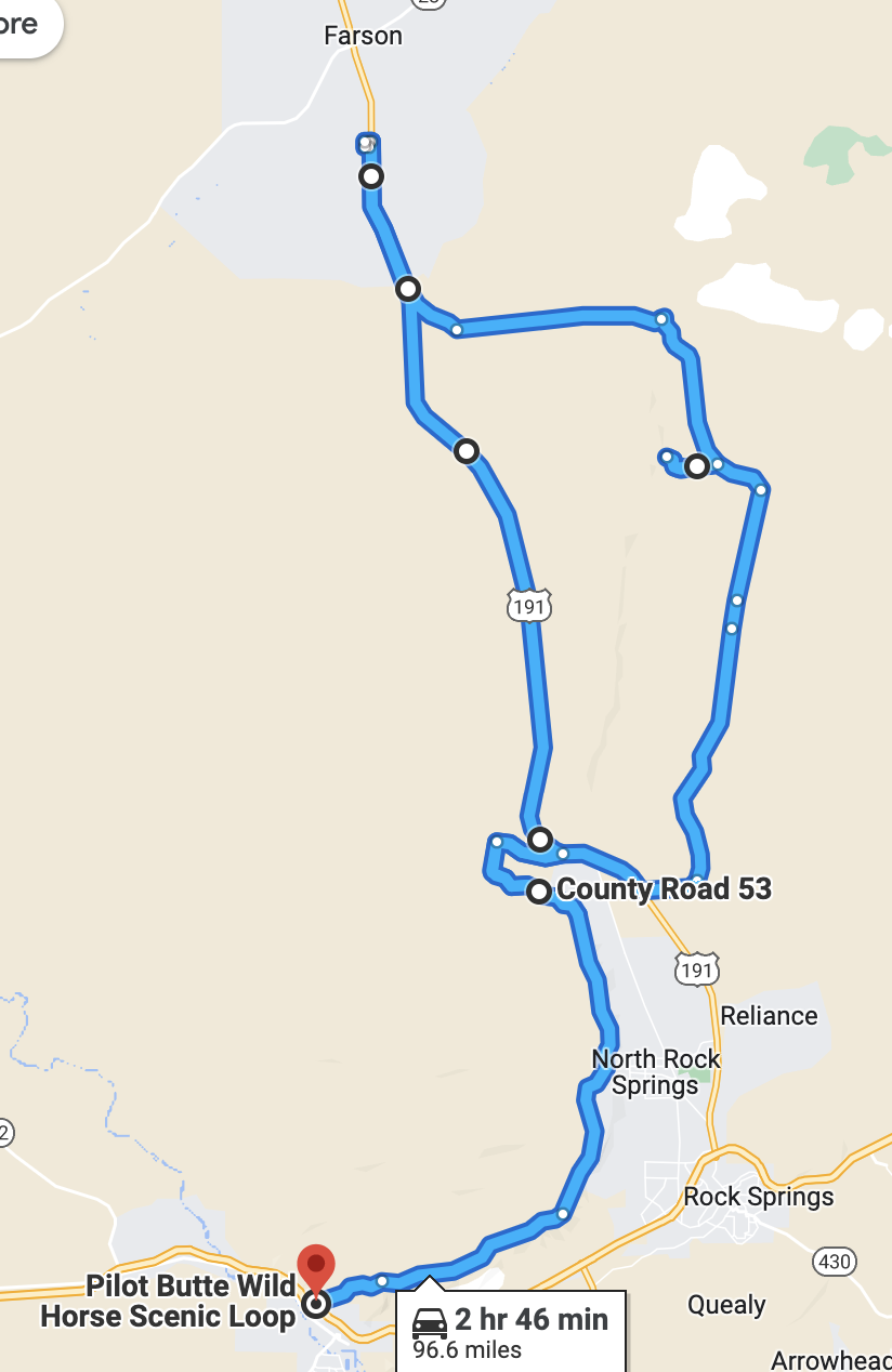
This morning, we slept in. Well, 0830 is sleeping in for us, it’s 9:30 in Pensacola and we are up and ready to hit the day. It is a quiet Sunday morning. We have a quick breakfast at the Outlaw Inn, and head out with our friend Google Maps to find White Mountain, and our first petroglyphs of the trip.
It’s an easy drive, just turn right outside the Outlaw Inn and then turn right onto a pretty good County Road. It’s a dirt road, but well maintained. Then we turn onto another county road, a road less travelled. And then Google tells us we’ve missed our exit to White Mountain. What?? There was not a sign of an exit! Not a road sign, not a track, not a visible indicator of a way. We back up. We get out. Oh. There. Faint tire marks turning off the road. AdventureMan goes further on foot to make sure the road continues.

The tracks are more visible once you are actually out in the field. We have an AWD vehicle, we have experience – so we decide to continue on the track. We continue for about half a mile, and the ground is softer. We have visions of being rescued, elderly, dehydrated, because we’ve bogged down out of sight of any road . . . we turn back and decide to follow the county road.
We are so glad we do. Just a couple miles further, we see signs for White Mountain Petroglyphs, and then come to a legitimate turn-off, a marked turn-off. Part way to White Mountain we see those tracks join the road, and we are glad we are not still out there in the field, worried about getting stuck in the sand, no shovels, no cardboard, nothing to help us free ourselves.

Although remote, there is a parking lot, a long-drop toilet, and a clear trail to the base of the mountain, and a clear trail – straight up.
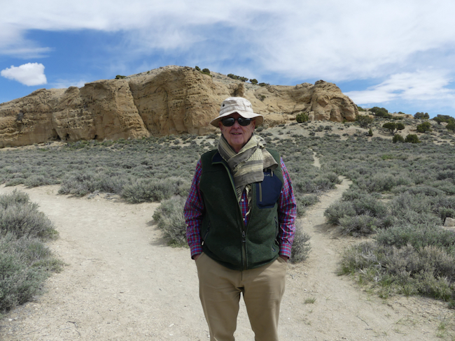
Although Rock Springs is not as high up as Denver, we are still adjusting to the altitude and the dryness of the air. It is still cold, we are glad of it, because the hike heats us up and we take it at a comfortable pace because the air is so dry and our lips and faces are chapping.
Totally worth the hike. While these are not the best-preserved petroglyphs we’ve ever seen, they are original and intriguing. There is also a lot of modern-day petrographic activity of the high school demographic.

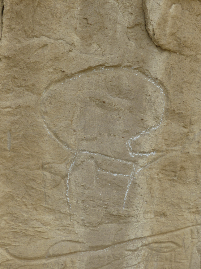
The standard rule with petroglyphs (carved into rock) and petrographs (drawn onto rock) is NO TOUCHING. No rubbing, no outlining with chalk, nothing which might degrade the incision or erode the lines. Someone has used chalk, probably a guide, to help viewers understand what they are seeing. If you know anything about petroglyphs, you know that we can speculate, we can ask modern-day First Nation people, and in the end, it is all speculation. Are they celebrating a triumphal hunt? Are they imploring the spirits to be available for the hunt? Are these incised bear claws a tribute to the bear’s strength? A brag about a bear-clan strength? We can only guess.


Boars Tusk is the remnant of an ancient volcano thrust 400 feed above the plain; an instantly recognizable landmark for hikers (and people looking for White Mountain.)

We are pumped. We’ve spent a couple hours traipsing around the mountain, seeking out these obscure petroglyphs, trying to decipher what they were meant to communicate. Bottom line – we don’t know, but we are exhilarated and delighted to have found this site.
The county road loops back around to the main road to Farson, and we know that just short of Farson is the Sweet Water Smoke, a barbecue restaurant we’d like to try. We are famished. Hiking and cold fresh air will do that to you!
We find Sweet Water Smoke and are delighted. It is small, and four of the five tables are taken, which leaves one for us. The entire time we were there, people were coming and going, take out orders rolling out the door, this place is humming with activity.
And no wonder! This is not ordinary barbecue! Their cole slaw is Sriracha cole slaw. They offer roasted brussel sprouts as a side, along with more traditional baked beans, macaroni and cheese, etc. I was just blown away to find roasted brussel sprouts as a side in a small Wyoming town. We remember one time traveling through Wyoming when we felt desperate for vegetables and were told to go to this “wonderful restaurant with a salad bar.” The steak was delicious. The salad bar had potato salad, cottage cheese, jello salad, and macaroni salad.
Sweet Water Smoke changes out two additional entrees every week and features a goat-cheese cheesecake with chocolate ganache. Who could resist?


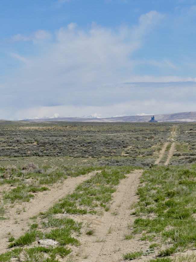
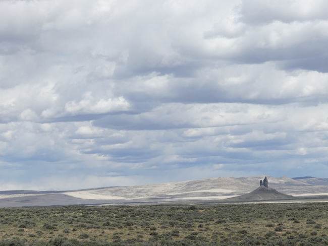
There is a route we want to follow next, the Pilot Butte Road, which is supposed to be challenging, but I think they may have improved the road since we read the warnings because it was easy with our AWD. Having said that, we passed another group busy changing a tire; the road was dirt and gravel and some potholes. Not what we would consider challenging, but a road where we took care.
We were looking for the herds of wild ponies.

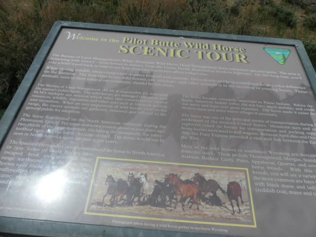


No wild horses in sight, but some mind-blowing expanses of scenery along the track. There were inescapable signs of wild horses, piles and piles of signs of wild horses, but we never saw a single wild horse.

In front of us is a valley where Interstate 80, the old Lincoln Highway, runs. It is also where the Pony Express trail ran before the coast-to-coast railroad took over prompt mail delivery. It makes me sad to see that prompt delivery of mail is no longer a priority for the US Mail system. Here also ran several of the migratory trails as America moved westward. What courage and initiative it took – blasting away hills, bridging canyons and rivers, tunneling through mountains and building across swamps – feats of imagination and engineering. We are in awe of the minds that solved these problems.
Recent Comments
ExpatAlien on What Country am I Living … intlxpatr on Yellowstone: Old Faithful to C… Michelle on Yellowstone: Old Faithful to C… Cathy on No Grown-Ups in Charge intlxpatr on Waiting for Snow Wikipedia Donate Button

Amazina

Early Voting in Florida


