Google Earth Adds New Layers
Google earth, according to OogleEarth has just added some new layers, one in particular of which highlights what is going on in Dharfur, and ties it to the United States Holocaust Memorial Museum, which tracks deaths, attacks, and refugees in the Dharfur region.
Many thanks to my source at GoogleEarth and greetings, Earthling! (I love saying that!)
Mediawatch: Covering the new Darfur default layer in Google Earth
Wednesday, April 11, 2007 (10:38 UTC)
Hundreds of media organizations carried news about the new Darfur layers in Google Earth — and that’s just in English. In Sweden alone, over 40 papers ran the news (an example). In the US, many local news organizations and papers ran the AP or Reuters story. Here’s a rundown of links to some of the larger and/or more interesting ones, with some observations at the end:
Using their own correspondents: The Los Angeles Times (business), BBC (front page feature), CNET (front page, and as a top headline for media 2.0), CNN (technology), Washington Times (business), PC World, ABC News (world news) and a good article/blog in Wired.
Reuters: Australia’s The Age (under technology), New Zealand Herald (world news), The Australian (world news) and Scientific American (science news).
AP: Seattle Post Intelligencer (business), MSNBC (technology), The Guardian (world news), Sydney Morning Herald (technology), the Houston Chronicle (markets), Seattle Times (world news), CBS News (technology), Baltimore Sun (world news), Washington Post (technology), San Jose Mercury News (breaking news), San Francisco Chronicle (business), Denver Post (world news), International Herald Tribune (Americas??) and the Sudan Tribune (which is a great resource for Darfur news, it turns out — pity they don’t have RSS).
AFP: Times of India (world news), iAfrica (technology) and Baku Today (technology).
IDG News service: IT World and InfoWorld.
What’s interesting is that there is no consensus among news editors as to where such a story belongs: Is the story’s most important news component the fact that there is a genocide being perpetrated in Darfur (world news), that new technologies are being employed to educate people about Darfur (technology), or that Google is involved (business)? In a sense, the situation in Darfur is not itself a “news” story, in that we all already (should) know what’s going on there. (If anything, the news is that it’s getting worse at the moment, and people I know who work there are doing so without much hope of a resolution anytime soon.) But putting the story in the technology section relegates it to a spot not followed by the people that the technology is most aiming to reach.
I think this is above all a story about how new technology is letting us all be witnesses to a genocide in progress, and how that raises our own responsibilities — so perhaps this is a story best also told in the glossy Sunday newspaper magazines, read when people have more time to play with Google Earth and where there is more room for long-form stories about larger technology trends coupled to humanitarian crises such as Darfur, but also Katrina/New Orleans and the Pakistan quake from 2005. How about it, New York Times?
My opinion: This has got to be one of the greatest blogs on earth. And he emphasis added in the above paragraph is mine.
Google Earth Update
My nephew, Earthling, who works for GoogleEarth, makes the following recommendation:
“there are a lot more panoramio photos now. . . “
“Spain and France are both completely covered in 2.5 meter imagery or better now. Switzerland is now 100% high res and has new improved terrain. I highly recommend turning on terrain and flying through the alps. Highly recommend it!”
Have fun!
(If you don’t have Google Earth yet, you can download it here. It’s FREE.)
Google Earth for Dummies!
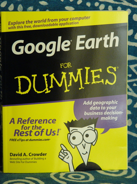
I’ve been on the waiting list at Amazon for months, ever since my nephew, Earthling, wrote me that this book was in the works. (thanks, Earthling!) It arrived this week. Wooooo Hooooo!
Yes, I love GoogleEarth. I soar and swoop, look at my house in Seattle, look at different places in Qatar and Kuwait, go to Florida and visit my son – all via Google Earth. With Google Earth for Dummies, I can now do even more. Like all the Dummy books, the writing is simple, there are a lot of illustrations, and it tells me things I would never otherwise know.
It’s $16.49 through Amazon.com, plus shipping, of course, and you can find it here.
Google Earth – Map Your Books!
More news from Earthling (not quite my co-blog writer, but he sure gives me some good stuff to share with you 🙂 )
“This just launched, very cool. Google books search now lets you see a map of all the place mentioned in a book.
Go to books.google.com
Search for your book
Click the ‘about this book’ link.
example: Pride and Prejudice
The 9/11 Commission Report
911 Commission Report
Our Vanishing Wild Life: Its Extermination and Preservation
By William Temple Hornaday
Vanishing Wild Life
The great cities of the ancient world, in their glory and their desolation
By Theodore Alois W. Buckley
Ancient Cities
The Book of Ser Marco Polo
By Marco Polo, Henry Yule, Henri Cordier
Marco Polo
Adventures of Sherlock Holmes
By Arthur Conan Doyle
Sherlock Holmes
Kiss Kiss Bang! Bang!: The Unoffical James Bond 007 Film Companion
By Alan Barnes, Marcus Hearn
James Bond”
Travels of Ibn Batuta AD 1325 – 1354
Ibn Batuta
My comment: The maps usually showed up on the lower right part of the page, not always immediately visible, you have to scroll down. Not every page had a map, but the reference led to other similar books which had maps.
I didn’t even know Google had a book search section – and it is good! When I am reading, I like to read a train of books on the same subject – and I like the way Google gives small summaries which can give you an immediate indication whether this book will interest you or not. Thanks, Earthling!
Publish Your Photos on Google Earth
This is from Earthling, my nephew, who works at GoogleEarth, about contributing to the content layer of GE:
“Okay, it’s not technically Google Earth, and we don’t accept pictures that are too personal, but this can be done. I don’t know if you’ve played with the Panoramio layer in Google Earth (it’s on by default), but if you click the little blue and white circles that look like compasses, up pops a photo someone took. Its a lot of fun browsing these, they are by far the most popular layer we have.
How do you upload your photos? Go to www.panoramio.com and make an account and just start uploading. In order for them to eventually display in Google Earth, you need to give them a location. To do this, start uploading a file, then click the Map this Location button, enter a city name, pick the country/state from a list, and it show you a google map of the location. You can navigate in this just like on Google Maps, and when you find the spot where you took your picture, just double click on it.
The upload time takes a long time… so I don’t know how performance will be. Also, we (Google) don’t display photos of just people anymore. They will simply be removed from the feed panoramio sends Google. The layer is not real time, it gets refreshed every month or so.”
My comment: I uploaded a photo to Panoramio and it didn’t take me much time at all, even with my unreliable QualityNet connection. But just as with WordPress, I downsized the pixels in the photo considerably.
Recent Comments
ExpatAlien on What Country am I Living … intlxpatr on Yellowstone: Old Faithful to C… Michelle on Yellowstone: Old Faithful to C… Cathy on No Grown-Ups in Charge intlxpatr on Waiting for Snow Wikipedia Donate Button

Amazina

Early Voting in Florida


