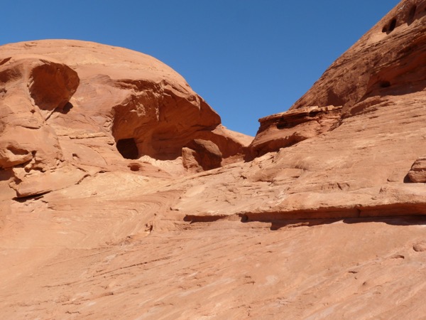
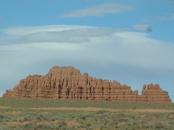
Hiking for Petroglyphs in Mesa Verde


We got up early to head for the Ute reservation park center, where you find tours to take you onto the Ute reservation, only to find it was closed. It’s a beautiful morning, although there are some threatening clouds, so we had to nearby Mesa Verde, stopping at the Cortez welcome center where a kind lady tells us about the Spruce House petroglyph trail, a 2.4-mile trail, fairly easy, she tells us, which reassures me because I am in a skirt and sandals.
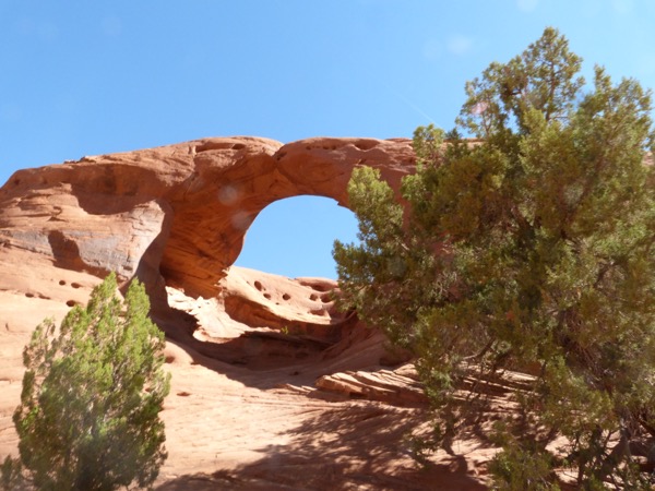
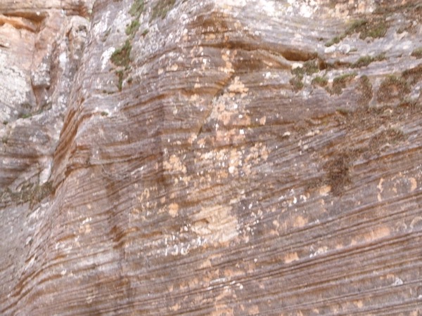
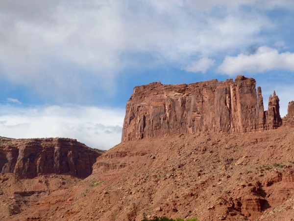
We love Mesa Verde. We’ve been here before, and we can see there have been a lot of major improvements since the last time we were there.

Some of the roads are still not open, due to damage over the winter, but the hike to the petroglyphs is open.
As we drive into the Spruce House parking lot, there is a great parking spot, and as we turn into it, there is a woman in the next car, pulling things out, and scowling at us like “go somewhere else to park!” AM couldn’t resist chatting her up; it looked like she had her entire household packed in her car and no matter how nice he was, she was crabby and negative in return. We couldn’t help but laugh.
We ask the Ranger at the Museum about the Spruce House trail and he tells us there is one place, just past the petroglyphs, that is a hard vertical climb, but the rest is easy.
It was not. This was one of the hardest hikes I can remember in a long time, with many steep narrow stone ascents and descents.

Just as we entered Mesa Verde, my camera battery had gone, so I only had my phone camera, not my bigger camera, which turned out to be a really good thing. By the time we discovered how hard the trail would be, we couldn’t really turn back, so we made frequent stops to calm our heart rates. Some hikers passed us heading back, some because they had tour times they realized they couldn’t make it if they completed the hike, and some just turned back because it was too hard.


We gutted it out. There were times we just laughed.

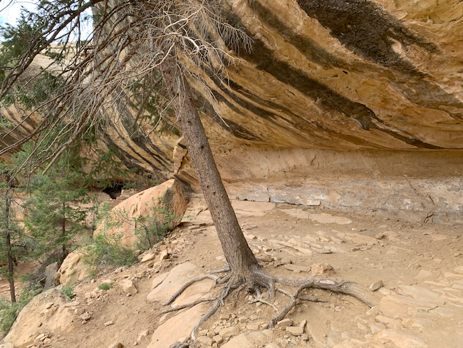

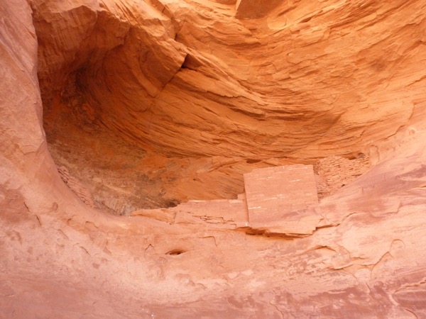
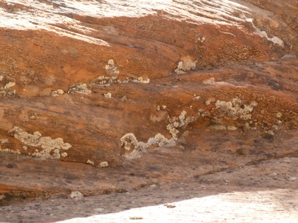
We made it to the petroglyphs, and appreciated the beauty of Spruce Canyon. We were on many narrow little trails on which a false step could result in a long, dangerous fall, which made us very intentional in our foot placement, and slowed our pace.


Just after the petroglyphs we came to the place the Ranger had described. People were turning back. There were places that required finding a place to plant your foot where you could lift yourself to the next level, raising the other leg.


That I could do! I do it three times every week, exiting the pool! It is the same movement! We waited for another group to pass us – me being in a skirt and having to raise it to execute the climbing moves up the rocks. We stopped a couple times in the climb just to catch our breaths, to slow our hearts, and to appreciate how difficult this was, and we were doing it!

Once we got to the top, there was a smooth, easy path back to the museum. We took it slow, our thigh muscles were aching from all the ascents and decents, and my hips were aching from the climbs. We were so thankful just to finish the hike, but we were laughing at the description of this hike as an “easy level trail.” We later learned it was listed as a strenuous hike, a description we would agree with.


Just happy it’s over. We made it. We made it!

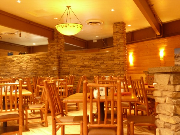
On the way home, late in the afternoon, we stopped at a Mexican restaurant in Cortez which had intrigued AdventureMan; Gustavo’s.
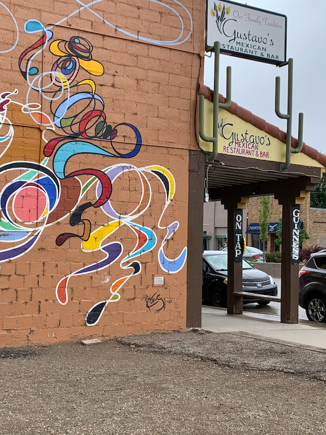
We really liked it. I ordered three street tacos al pastor, and AM ordered the chicken mole.


We were both delighted with our orders; mine were small tacos with just meat and onion and cilantro, and a spicy sweet mustard sauce, absolutely delicious. AM’s mole was a WOW, with sweet tender chicken with a sauce that was decidedly chocolate but carried a big heat. As usual, we couldn’t eat it all, so we boxed up one of his chicken mole’s and an order of Gustavo’s lemon pie (it was more like a lemon tiramisu, with layers of pastry between layers of a mascarpone and lemon filling, amazing and unusual) to take with us for dinner.

When dinner came, we were still so full we just had a couple slices of the comte cheese and crackers for dinner, and that was enough.
Chasing Petroglyphs: Tour of the Tilted Rocks
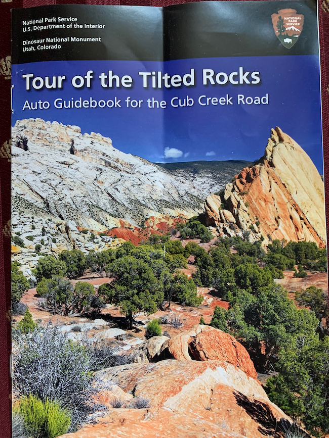
We leave the Wall of Bones to go back to the visitor center to pick up our car and hit The Tour of the Tilted Rocks.

Most of the visitors in this late May time frame seemed to be people in our demographic, 60s and older, people out exploring our country as singles and couples. We saw a couple of groups, and a couple of tours, but most of the people we saw looked a lot like us – retired, with the luxury of time to go exploring.
Most of these people were, like us, physically fit enough to climb the uneven trails, climb a few slippery rocks and hike straight uphill to view the petroglyphs.
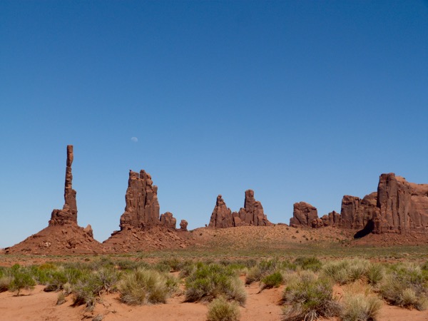
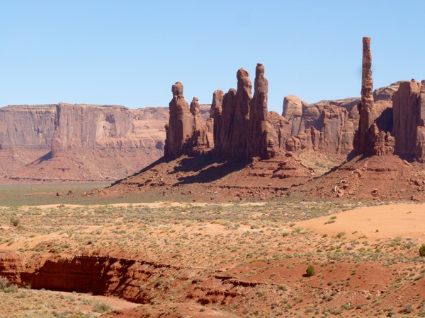
Leaving the Quarry Hall “Wall of Bones,” we got into our car for the “Tour of the Tilted Rocks” and spent the next couple of hours engaging with the spectacular scenery, helped along by both the brochure and the frequent guideposts along the way. We visited four separate petroglyph sites and countless sites of geological and paleontological interest.

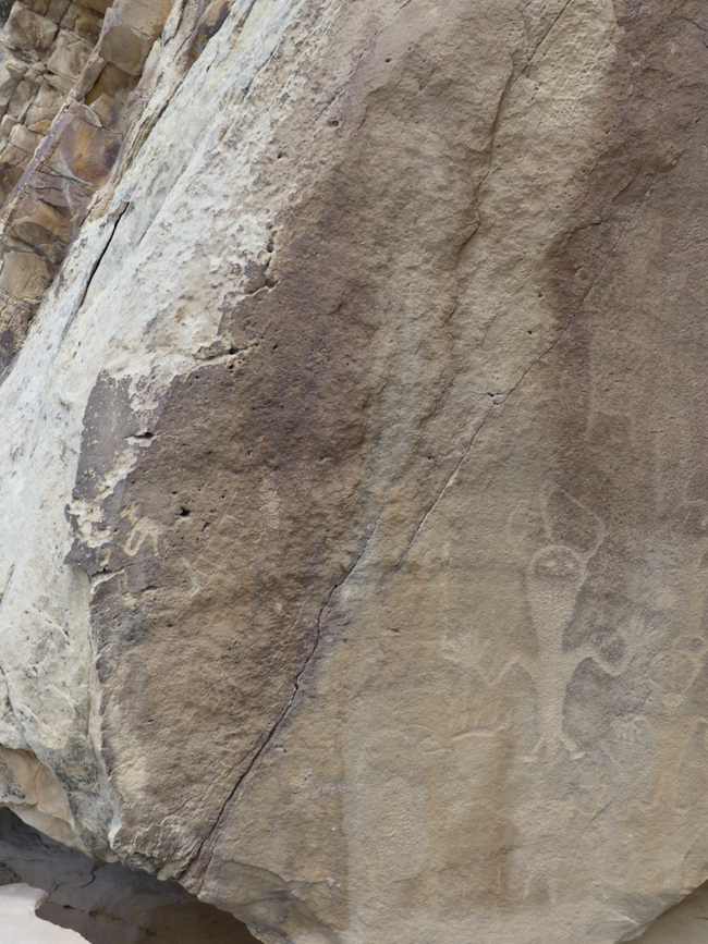

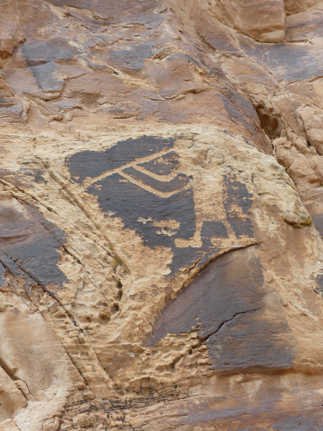
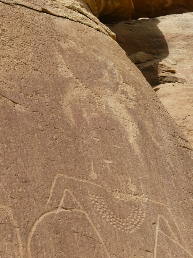
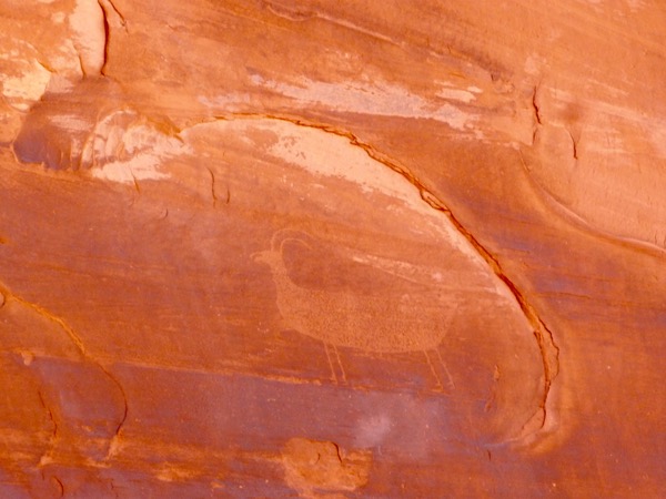
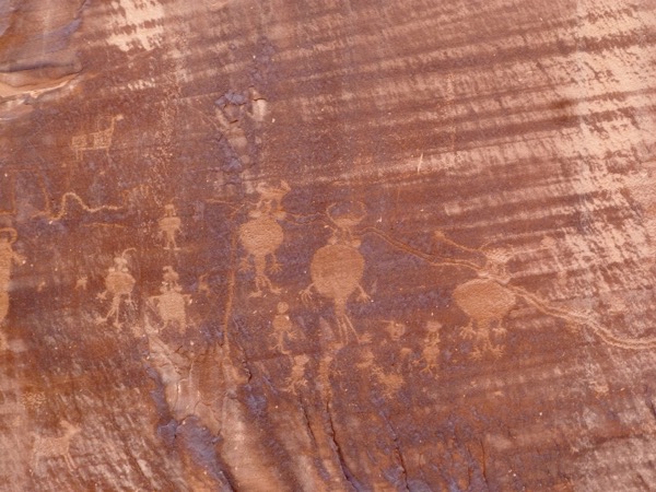
A wealth of petroglyphs! I can see similarities in these glyphs to the Fremont glyphs we saw yesterday, but these are more on the level of scratch sheets, practice for the advanced figures we saw at the McConkie ranch. You can see some elementary necklaces. I overheard in a passing group a person say that square heads are men and more rounded heads are women. I’m not sure that is true, but now I have more to evaluate.


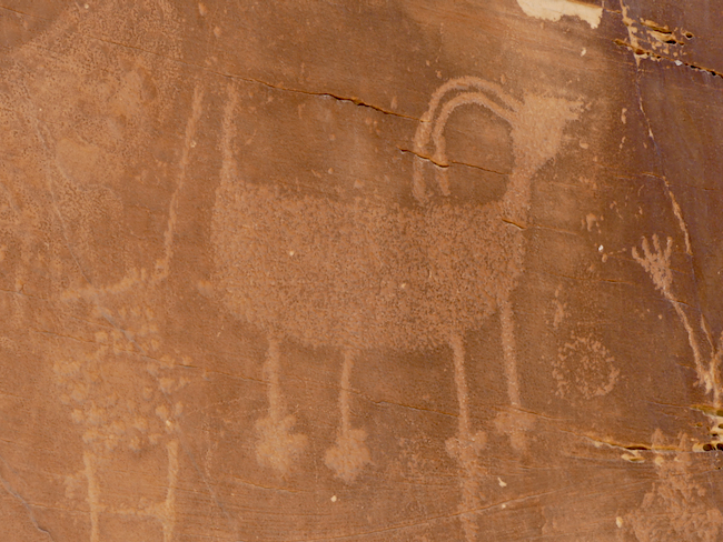
Yet another site; love this . . . headdress? Or is it a jug with flowers – and legs?

The shoulder – waist proportion appears to be still evolving here. I can see a crescent moon and indications that some figures are probably men. Or maybe fertile women, with the moon?


So does the round head mean this is a woman? Her body seems more elaborately patterned than others. She appears to be waving. In some cultures, the spiral indicates long life, but maybe it can also mean a trail of life or a giver of life? More questions than answers 🙂

As the day heats up, these climbs seem more aggressive. We have hats, we have water and the dry heat sucks the moisture out of us.

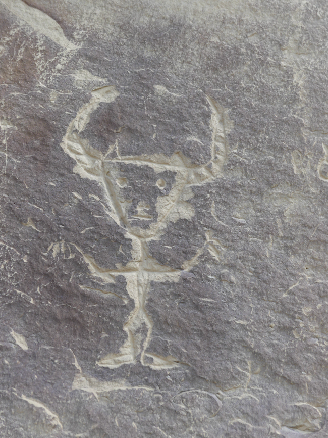
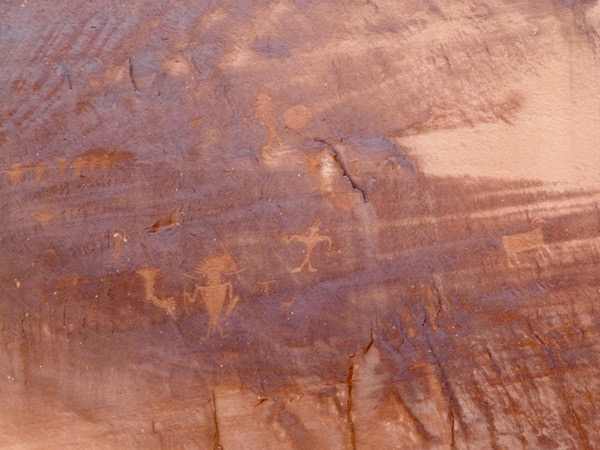
So, a square head with elaborate patterning, maybe slaying a deer? So no, elaborate patterning is not a female thing.


This site has a lot of lizards


I would love to know what this is about. An altar, with celestial bodies above? I wish I had a clue.
On the way back to Vernal, we had lunch at the Naples Country Cafe. I ordered the Naples Country Breakfast, and thank God for a helpful waitress who asked me what kind of gravy I wanted over it all. I hadn’t read it very carefully, just saw that it had a couple of eggs. She advised me to get the Junior version of it, and I asked for no gravy, no cheese. What arrived at the table was two eggs over easy on a plate full of hash brown potatoes, with a sausage, a slice of bacon and a piece of ham, and two slices of sourdough bread with homemade boysenberry jam. I was picky about what I allowed myself to eat, but I did eat all the jam, on half a slice of bread, because it was so irresistibly delicious.
We got back to our room mid-afternoon to rest or nap a little, and to pack up for our drive tomorrow down to our cabin outside of Moab, Trail’s End at Pack Creek, which we hope will provide four nights of spectacular night sky viewing.
Chasing Petroglyphs, the McConkie Ranch
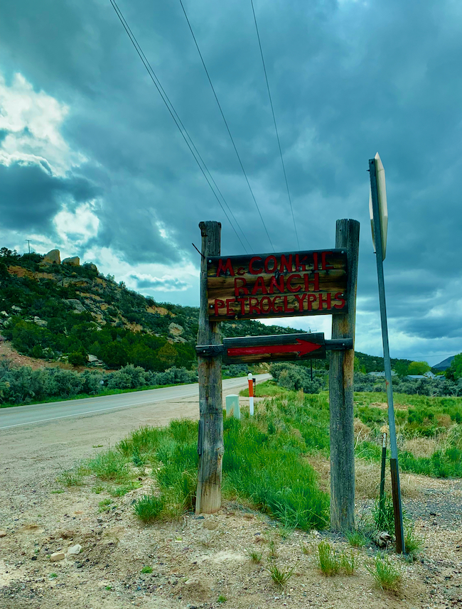
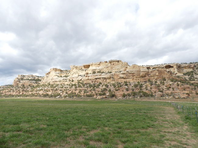
Imagine a ranch at the bottom of a huge long red cliff, a private ranch, which allocates land to public parking and has created a path about a half a mile to the cliffs and then up the cliff itself, to the shelves where the petroglyphs are.
I hope they had volunteers helping, as there were steps and a well-cleared path to help us make the climb. To top it all off, there is no charge. There is a donation box in the parking lot. There is signage, there are marked trails. This is the generosity of the human spirit in action, making these petroglyphs available to those of us who take an interest in them. Not charging us anything, trusting we will donate. Creating paths and a place to park. God bless the McConkies.
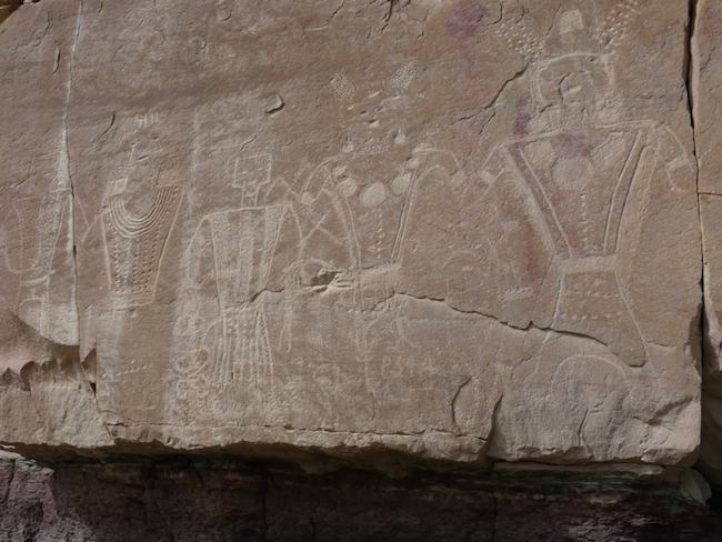
We are delighted we can still make this sort of trek. While the path zigzagged, it felt like we were going straight up. In places, we needed to climb up rocks. We were both panting when we reached the top, but oh, it was so worth it. These petroglyphs, were Fremont people petroglyphs, some very simple and dramatic, but many glyphs of people with elaborate necklaces, headdresses (or else they were aliens), and clothing. It was worth every minute of the climb. These are some of the loveliest petroglyphs I have ever seen.

We were very conscious as we climbed that it was dangerous. There were slippery spots, and other places which required some climbing. It isn’t just a matter of fitness, it is also a matter of acclimation to the altitude – AdventureMan and I were both very aware of how vulnerable we are, making these climbs. And we are so exultant when we make it to the top. We can still do this!
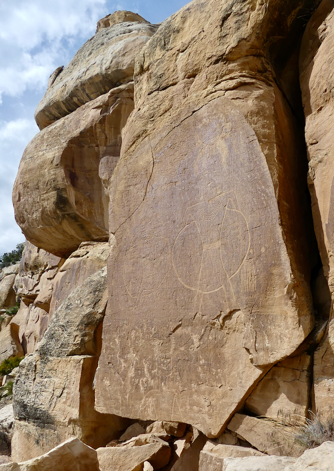
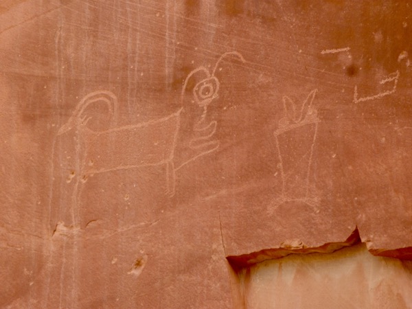
What does it mean that there is a circle around so many of the figures? Does it mean they are living? Does it mean they have moved on to the next life? Is it some kind of ancient hula-hoop? What I love are the bodies, the way these figures are more modern, with wide shoulders narrowing to a smaller waist.
Culturally, we tend to think of people wearing earrings and necklaces as female – are these female? No sign of breasts. Are they warriors? Priests? We don’t know.

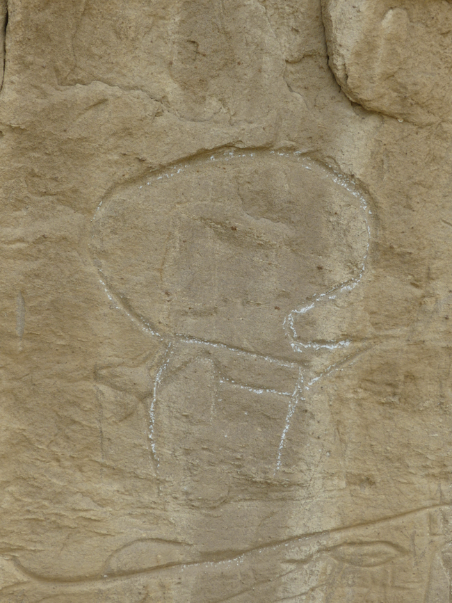
A purse? A warrior decoration? A metaphor for seeds and falling rain? This is a fertile field for speculation.

Circles. Ear decorations. Necklace. Eyes and Mouth!

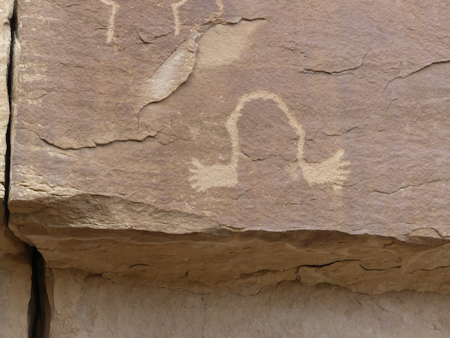
I am fascinated by the creature to the left. Some kind of skirt – corn husks? What would constitute a lower covering with separate strands? Gives a masculine feeling, but shoulders not so broad as the others. (Can you see why we chase petroglyphs? So much mystery!)

Parts are lost as rock cleaves and sheds . . . this head appears square, but what is this decorated halo-like circle around the top of the head? What is in his hand – is that a bell of some kind, with a clapper? The head of an enemy? A space suit helmet?
Look – horns! AdventureMan, who loves to yank my chain, says this is clear proof of aliens among us from earliest times, with their space suit and buttons and elaborate decorations.

So many questions. Feathers? What is he holding? What are the extra lines from shoulder to waist? Is that a helmet on his head?

AdventureMan would say that this is proof of jet-propulsion suits. I think it may have more to do with procreation . . . But what about this guy in the lower right, his head is more rounded and he looks like he has antannae?
These crack me up. It looks like a scratch-pad to me, practice for something else. But wait – see below – an entire section appears to have been cut away! Where is it? What is missing? I don’t even begin to know where to start looking for answers.

For me, this interlude, at the McConkie Ranch, physically challenging, in the heat of the late afternoon (but what great light for photos!) was one of the highlights of our trip. I look at this work by an ancient people and I marvel.
We have chased petroglyphs in Botswana and Namibia, in Saudi Arabia, in France, and in the United States. None have enchanted me the way these have.
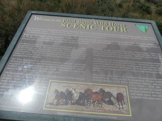
Chasing Petroglyphs: White Mountain, Eden and the Pilot Butte Ponies
This morning, we slept in. Well, 0830 is sleeping in for us, it’s 9:30 in Pensacola and we are up and ready to hit the day. It is a quiet Sunday morning. We have a quick breakfast at the Outlaw Inn, and head out with our friend Google Maps to find White Mountain, and our first petroglyphs of the trip.
It’s an easy drive, just turn right outside the Outlaw Inn and then turn right onto a pretty good County Road. It’s a dirt road, but well maintained. Then we turn onto another county road, a road less travelled. And then Google tells us we’ve missed our exit to White Mountain. What?? There was not a sign of an exit! Not a road sign, not a track, not a visible indicator of a way. We back up. We get out. Oh. There. Faint tire marks turning off the road. AdventureMan goes further on foot to make sure the road continues.

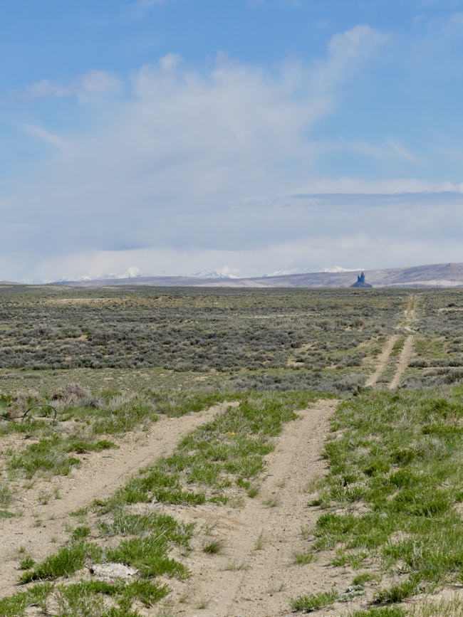
The tracks are more visible once you are actually out in the field. We have an AWD vehicle, we have experience – so we decide to continue on the track. We continue for about half a mile, and the ground is softer. We have visions of being rescued, elderly, dehydrated, because we’ve bogged down out of sight of any road . . . we turn back and decide to follow the county road.
We are so glad we do. Just a couple miles further, we see signs for White Mountain Petroglyphs, and then come to a legitimate turn-off, a marked turn-off. Part way to White Mountain we see those tracks join the road, and we are glad we are not still out there in the field, worried about getting stuck in the sand, no shovels, no cardboard, nothing to help us free ourselves.

Although remote, there is a parking lot, a long-drop toilet, and a clear trail to the base of the mountain, and a clear trail – straight up.
Although Rock Springs is not as high up as Denver, we are still adjusting to the altitude and the dryness of the air. It is still cold, we are glad of it, because the hike heats us up and we take it at a comfortable pace because the air is so dry and our lips and faces are chapping.
Totally worth the hike. While these are not the best-preserved petroglyphs we’ve ever seen, they are original and intriguing. There is also a lot of modern-day petrographic activity of the high school demographic.

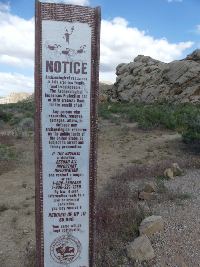
The standard rule with petroglyphs (carved into rock) and petrographs (drawn onto rock) is NO TOUCHING. No rubbing, no outlining with chalk, nothing which might degrade the incision or erode the lines. Someone has used chalk, probably a guide, to help viewers understand what they are seeing. If you know anything about petroglyphs, you know that we can speculate, we can ask modern-day First Nation people, and in the end, it is all speculation. Are they celebrating a triumphal hunt? Are they imploring the spirits to be available for the hunt? Are these incised bear claws a tribute to the bear’s strength? A brag about a bear-clan strength? We can only guess.


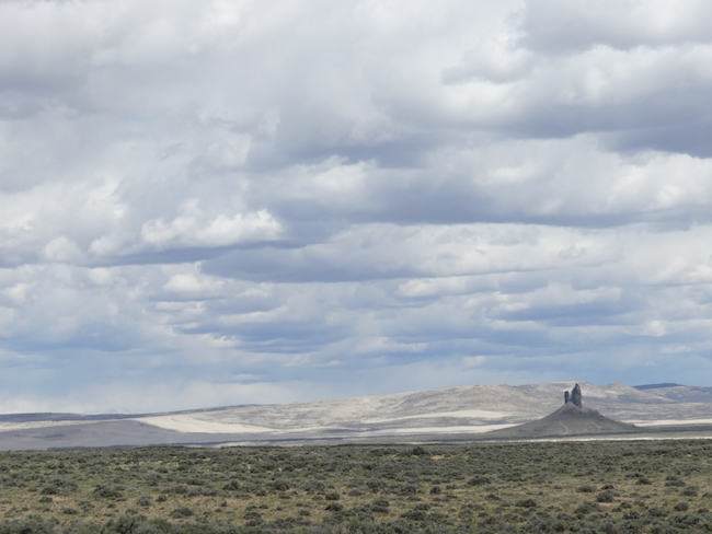
Boars Tusk is the remnant of an ancient volcano thrust 400 feed above the plain; an instantly recognizable landmark for hikers (and people looking for White Mountain.)

We are pumped. We’ve spent a couple hours traipsing around the mountain, seeking out these obscure petroglyphs, trying to decipher what they were meant to communicate. Bottom line – we don’t know, but we are exhilarated and delighted to have found this site.
The county road loops back around to the main road to Farson, and we know that just short of Farson is the Sweet Water Smoke, a barbecue restaurant we’d like to try. We are famished. Hiking and cold fresh air will do that to you!
We find Sweet Water Smoke and are delighted. It is small, and four of the five tables are taken, which leaves one for us. The entire time we were there, people were coming and going, take out orders rolling out the door, this place is humming with activity.
And no wonder! This is not ordinary barbecue! Their cole slaw is Sriracha cole slaw. They offer roasted brussel sprouts as a side, along with more traditional baked beans, macaroni and cheese, etc. I was just blown away to find roasted brussel sprouts as a side in a small Wyoming town. We remember one time traveling through Wyoming when we felt desperate for vegetables and were told to go to this “wonderful restaurant with a salad bar.” The steak was delicious. The salad bar had potato salad, cottage cheese, jello salad, and macaroni salad.
Sweet Water Smoke changes out two additional entrees every week and features a goat-cheese cheesecake with chocolate ganache. Who could resist?


There is a route we want to follow next, the Pilot Butte Road, which is supposed to be challenging, but I think they may have improved the road since we read the warnings because it was easy with our AWD. Having said that, we passed another group busy changing a tire; the road was dirt and gravel and some potholes. Not what we would consider challenging, but a road where we took care.
We were looking for the herds of wild ponies.


No wild horses in sight, but some mind-blowing expanses of scenery along the track. There were inescapable signs of wild horses, piles and piles of signs of wild horses, but we never saw a single wild horse.

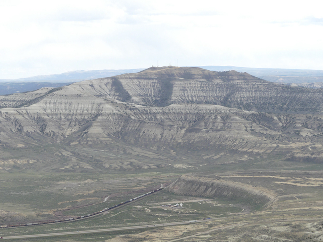
In front of us is a valley where Interstate 80, the old Lincoln Highway, runs. It is also where the Pony Express trail ran before the coast-to-coast railroad took over prompt mail delivery. It makes me sad to see that prompt delivery of mail is no longer a priority for the US Mail system. Here also ran several of the migratory trails as America moved westward. What courage and initiative it took – blasting away hills, bridging canyons and rivers, tunneling through mountains and building across swamps – feats of imagination and engineering. We are in awe of the minds that solved these problems.
Coming Up: Red Desert, Dinosaurs, Petroglyphs and Night Skies Travel

We take small local trips, but this is our first Spring Out-West trip since last year. We’ve got some highlights – seeing our niece in Denver (early readers know her as Little Diamond) and getting to know her growing children, staying in the Elk Hunting capitol of the world, Craig, Colorado (well, just because who knew?), exploring the Red Desert of Wyoming and visiting remote and rarely seen petroglyphs and pictographs, on through the Flaming Gorge to the Dinosaur National Monument, and then down to a cabin just south of Moab where we will be heading down to the Canyon of the Ancients, near the four corners area of the United States, for more exploration of ancient ruins, focusing on petroglyphs and pictographs. From there, a family meet-up in Breckenridge, a stay with my sister in Colorado Springs, and back up for one last family visit in Denver before we fly back to Pensacola.


The trip focuses on remote locations, petroglyphs, pictographs, and lesser-visited sites with dark skies, where we will stay mostly in cabins. We are always up to try to find an unknown gem, like the Traveler’s Rest Cabins, where we stay on the east side of Glacier National Park. (I see they are now for sale; I can only hope the new owners are as wonderful as the current sellers.)
Sometimes when choosing a hotel or restaurant, I am hooked by a clever name, so in Rock Springs, WY we will stay at the Outlaw Inn. It’s a Best Western, not a cabin, but I love the name. Rock Springs is also famous for herds of wild horses and outdoor activities.
The whole trip is outdoor activities, with an occasional visit to a specialty museum or two to help us understand what we see. We have two reservations at Arches National Park, the earliest reservations we could get so as to have the benefits of fewer people and the glorious morning light hitting the arches, and reservations for a sunset cruise on the Colorado River, for the same reasons – views with the glorious light of sunset. My husband wants to eat at a famous restaurant, the Sunset Grill, overlooking Moab, so we will make reservations far in advance – the place fills up quickly.
When we land, whether it’s Bozeman, Denver, Juneau, Portland or Seattle, we always give ourselves enough time to visit a local store to stock up on water, apples, oranges, peanut butter, crackers and necessities like tissues, paper towels, toilet paper, insect repellant, sunscreen – anything we might need and not want to carry in our suitcases. It gives us a lot of flexibility, so we don’t have to worry about finding a meal when we are remote. On the other hand, we love a good meal, so we plan to find places in advance, and make reservations. It works for us.
I’m getting excited just writing about it. Planning trips has gotten me through the COVID desert; even just doing the research and getting reservations gets my blood going faster as we anticipate new sights and experiences, new adventures.
And yes, I’m taking you with me 🙂
Monument Valley: A Day to Remember
When we decided to go to Monument Valley, we decided to go all out, and we are so glad we did. We had read you can go down and visit many of the places in Monument Valley on your own, which we often like to do, go places on our own. On the other hand, doing Monument Valley on your own, you could very well miss something important.
So we signed up with Majestic Monument Tours, for a morning in Mystery Valley and an afternoon in the regular valley below the hotel. Bright and early we met our guide, Hope, in the hotel lobby and our day began.
Immediately we were so glad to be with Hope. For one thing, she is knowledgeable, not showy but quiet and modest and full of good information, if you want to know. Second, she is a really great driver, and some of the places she took us needed four wheel drive. Third, many of the places she took us were also off-limits to people who did not have guides. Last and not least, the roads were as bad as any we have ever driven in Africa or the Middle East, and our little rental car might have suffered damage had we tried these excursions on our own. Going with a guide was the right decision, for so many reasons.
This was another best day of our entire road trip.
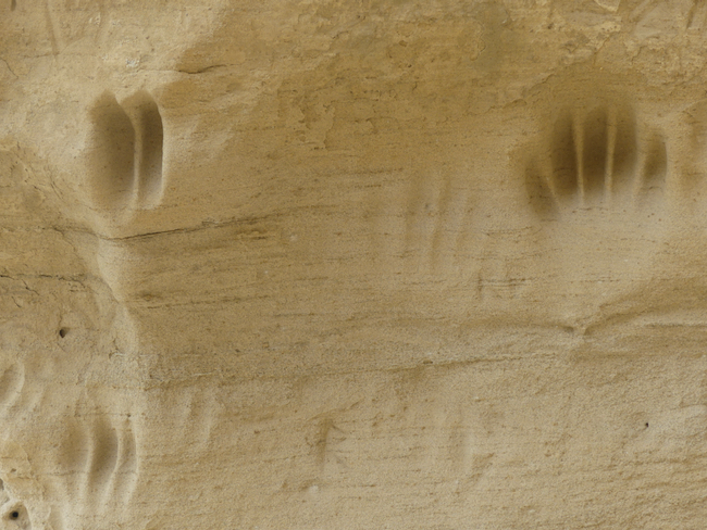
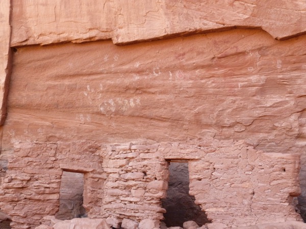
While it was still cool, we hiked up to some dwellings, straight up the red rock. I didn’t have any problem going up, I wasn’t worried about going up, it’s always going down on rock where I worry – loose pebbles can make your foot slip, and there are no soft surfaces on the way down. I did fine, and I thought AdventureMan did, too, only to learn when we got back to the hotel at the end of the day that he had actually slid and tumbled badly down one rock slope when he had gone up to photograph some hand prints in a location that I would not attempt.
This is the rock hill I climbed, early in the morning, while it was still cool. By later in the day, it was too hot for me, I would hike, but hide in the shady areas.

This is Hope, our guide, with me at the top of the hill, and the truck down at the bottom of the hill.

I risked it all for petroglyphs.
I was cooing and babying him, so sorry I had no idea that he had hurt himself, but he said “I didn’t want anyone to know, and the most important thing is I didn’t damage my camera.” LOL, so stoic, and here we are bumping around all day in hard seats mounted on a truck, like we are riding really difficult hard horses most of the day, and he doesn’t make a peep!
This is the cliff AdventureMan fell down. He had gone up to take photographs of family hand prints and petroglyphs on the wall. He was the only one who climbed up with Hope.
The day was full of wonders, including backdrops from old cowboy movies. When we cam back, AdventureMan reviewed a lot of the movies mentioned and would call me in and say “Look! Clint Eastwood is climbing that rock formation!” or “John Wayne is there with those cliffs in the background!” That was a lot of fun.

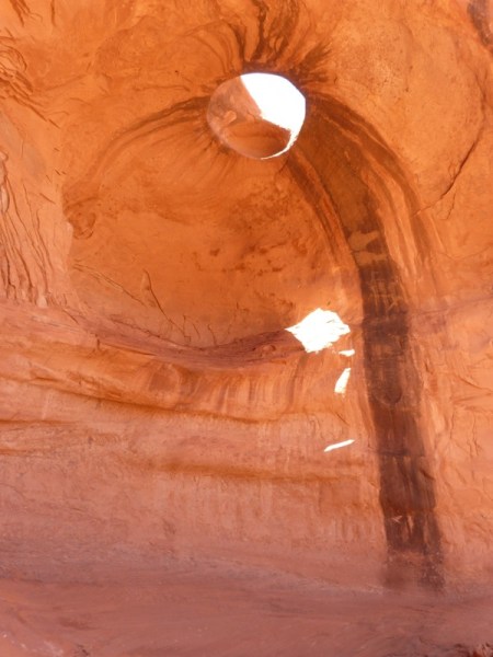
I love pictographs and petroglyphs. Can you see these?
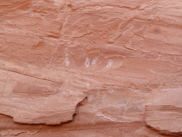


Here’s what I find interesting about the following two: each one has a right hand that is enlarged. I wonder if it is co-incidence, or if the enlargement of the right hand has significance? Look at the line coming out of the head of the top figure. That doesn’t look accidental, it looks intentional. What could it mean? These were intelligent human beings, problem solvers, artists. We have to give them credit for having as much capability of expression and intent as we have – or do we?


At one of the hollowed out areas, Hope pulled out her flute and played a haunting melody, echoed off the wall. It was a wonderful moment.


I liked this formation below a lot; it is called Three Sisters, and I am one of three sisters.

I think this was called God’s Eyes
And this was called God’s ear.
One of the classic cowboy movie backdrops.

Late in the afternoon, we got back to the hotel, grabbed quick naps (hey! it’s vacation!) and then headed to Amigos for a truly great dinner.
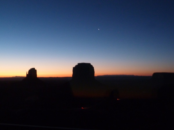
I woke up early to take this photo for you. This is sunrise in Monument Valley. You want this on your bucket list. Look, you can even see a star and the dim lights of the first trucks heading down into the valley to capture the early morning light. 🙂
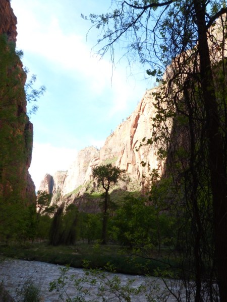
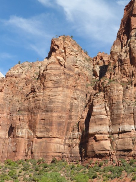
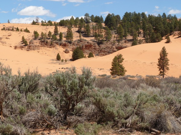
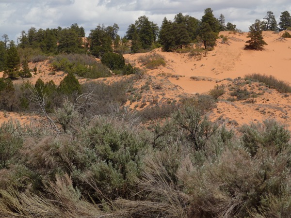
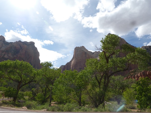
Zion National Park, Mineral Gulch and the Coral Sand Dunes
Wake up to grandeur in Zion National Park 🙂

It’s a little chilly for breakfast on the terrace, but the inside restaurant is nice, the wait staff is exceptional, professional, helpful and quick. When I saw blueberries available on another dish, and asked the waiter if I could add them to my oatmeal, it was a done deal. Don’t you just love it?


Most of the hiking groups who are tackling the higher peaks have already departed, but there are some elderly hikers getting a later start. We hike, but we are not group hikers. We like to set our own schedule and our own pace, but we admire the groups that have been hiking for years and adapting to one another’s styles. They have a great camaraderie.
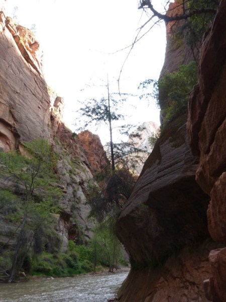
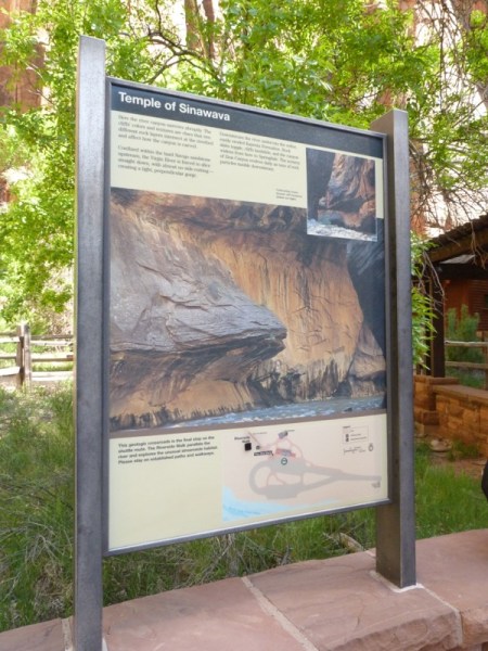
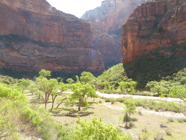
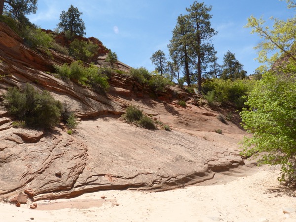
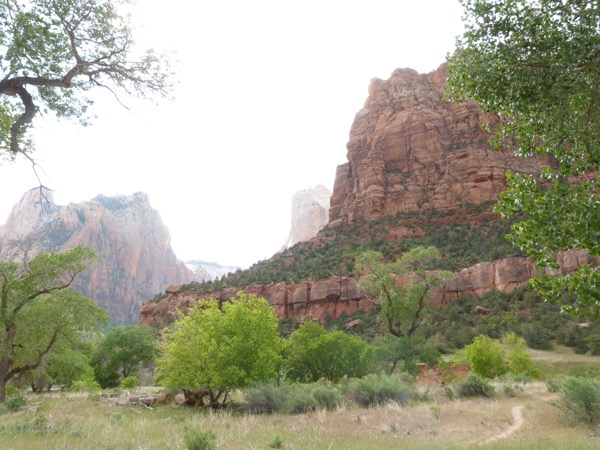
We have to take the shuttle to get deeper into the park, so we go all the way to the end. Our plan is to do the Riverwalk hike, then work our way back to the hotel. At this time of the morning, there are only adults, no children. The children arrive on buses, hundreds of school children brought to the park nearing the end of the school year, to show them the wonder of our country’s natural beauty.
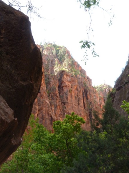
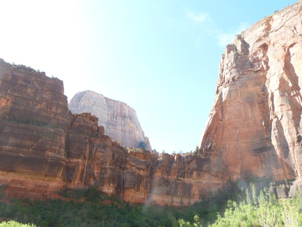
The Riverwalk is awesome. It is glorious, and relatively easy, and relatively safe. You reach a point where it says “no wheelchairs beyond this point due to the grade” and realize that even to this point, there have been steady ups and downs.

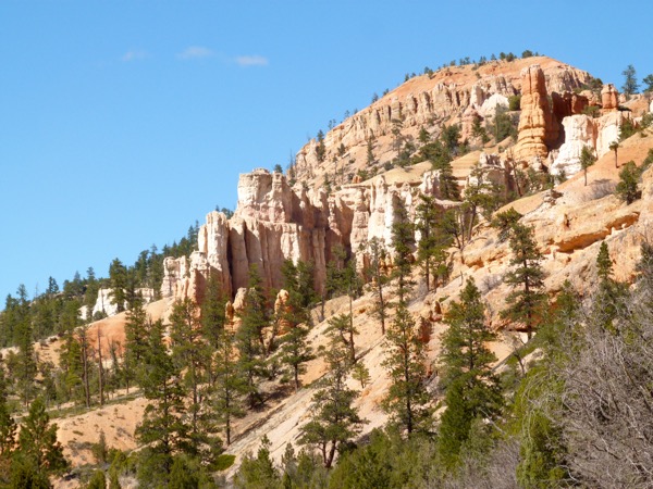
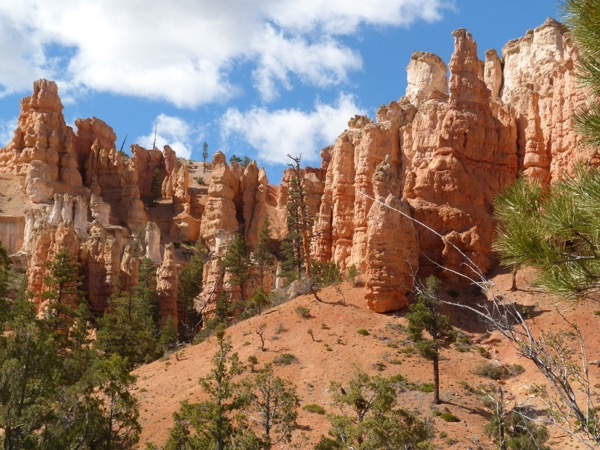
The beauty is so totally different from Bryce Canyon, we are in another geological era and we are viewing it all from below, rather than from above. This reminds me very much of Yosemite, with Capital Dome, and all the granite. The color mixtures here are wonderful to behold.

You can see that the path is mostly smooth, and paved, with an obstruction here and there to keep it interesting and natural.


There are rockfalls along the path, giant rockfalls. Anyone with an inkling of imagination can realize how short life can be, how unpredictable, how chaotic.

It is so early that the river itself is mostly in the dark.
Wonderful plants and flowers find enough nutrients in crevices and eroded places to explode into life.

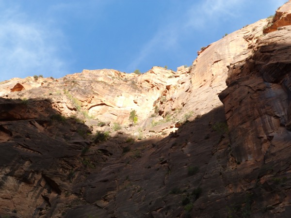
Look at those trees, clinging to life at the tops of these cliffs!


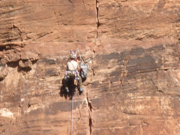
I spotted this, and followed the line up.

AdventureMan, with his sharp eyes, spots an anomaly on the side of the cliff:
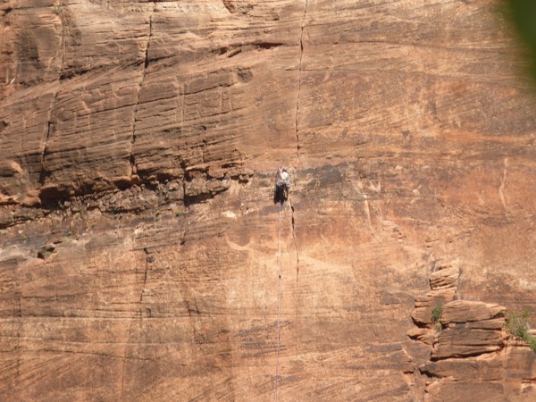
We think this is one of the park employees, creating safe climbing areas for those who like to go straight up, using ropes and pitons and you know, climbing stuff.

Leaving Zion, we are exploring Mineral Gulch, just outside Zion National Park, where we are told there are pictographs. I will tell you the truth, but do not do what we did, it is not safe. AdventureMan went one way, and I went another. I found a dry stream bed that looked promising, and I followed it.

Doesn’t this look exactly like where pictographs would be?
Or this? Oh, I wish AdventureMan were with me, with his sharp eyes. Even as I am thinking how very wrong and stupid it is to be off exploring separately, not together, I keep going a little further, a little further. Every now and then AdventureMan and I shout back and forth, but it’s been a while since I have heard him. I know I need to go back, I know it, but maybe, just around the corner, are the pictographs.

We never found the pictographs. I found a lot of places where I think they should be, but if they were there, I didn’t see them. Hot, tired, dehydrated, we headed for Mt. Carmel Junction, where we found this crazy funky restaurant, and got our orders in just before the Korean tour bus arrived.

Club Sandwich for AdventureMan:

Taco Salad for me. Very different, lots of peppers, lots of salsa. Very tasty, not a lot of beans or meat.
AdventureMan has spotted another remote road going to Coral Dunes State Park. I keep thinking we are on the wrong road, and he keeps insisting this is the road, it is the only road it can be. We are not arguing, we are just not on the same page. He was right. We find the Coral Sand Dunes, and they are beautiful.
He has shown me the road on the map, and we THINK we can make it, but his rental is a little low to the ground. I notice that the road number obscures the fact that for four miles, going into Arizona, the road is actually a track. We hold our breath, as the pavement ends, the road turns into washboard, the road forms crevasses, and we just hope the road doesn’t wash away. This is one of the longest four miles ever.

Safely off the track, we hit Springdale, just outside Zion, for ice-dream, and for sandwiches for dinner. They have a mercantile shop with a sandwich shop inside, with gourmet sandwiches. AdventureMan has an Avocado Veggie special, and I have a Reuben, and we find some crazy great T-shirts for all the little ones.
Back in Zion, the light is fading fast.

The horses are being taken back to rest up for the next day.

My feet are sore from the uneven smooth rocks in the creek-bed, and I am still a little dehydrated. Sure wish we had found those petroglyphs.
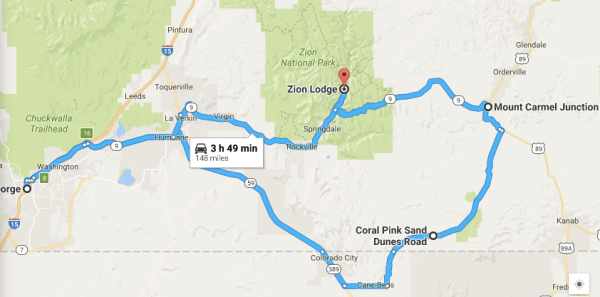
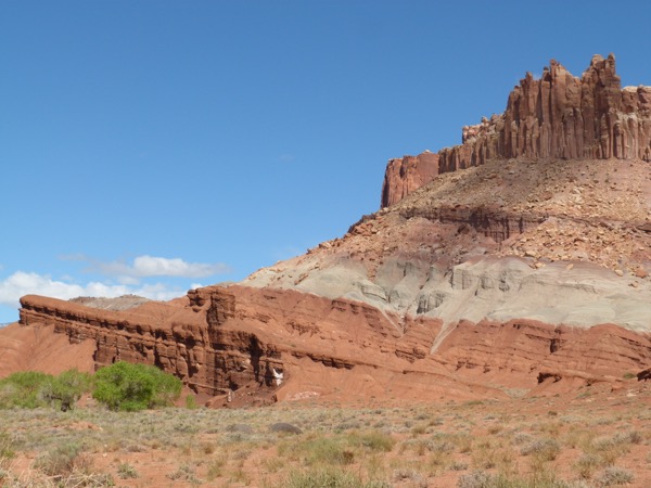
Moab to Tropic, Bryce Canyon And a Wonder-Filled Detour through Capitol Reefs
We are still on Pensacola time, so early rising is a piece-of-cake. Quick breakfast, quick departure. We had looked at the options the night before, we could go directly to Zion via fast roads, or take a southern route which would take considerably longer. AdventureMan had looked at the map and suggested a third route, which took longer, but not so long as the southern route, and took us through a place I have never even heard of, Capitol Reefs.

We’ve lived in so many wonderful places, and, because AdventureMan’s job was always so demanding, I took care of trip-planning, finding places to stay, creating routes to travel and choosing sights to see. This way is so much better, AdventureMan has the leisure to look at the maps, and he has good instincts. This day was another best day of the trip. 🙂
(Yes, I know, technically, they can’t all be best days. Toward the end we had some more boring days, but each day brought wonders and joys, and this is one of those best days, honest.)
One thing we never want is to find ourselves miles from a gas station in a remote location. As we are filling our tank, leaving Moab, I see one of our contemporaries loading up for his own adventure. This is what I love about Moab, you are free to pursue your own adventure.

If you are thinking about taking this trip, or a trip like it, you need to know that our phones had no service much of the time. Fortunately, we had maps and are good at reading them, mostly. It is really important to have some kind of back up when you are in remote locations. If you rely on your phone, and there is no service, you will have a harder time.
The scenery, even along the major highways, can be distractingly spectacular. This is, I believe, along I-70, which we take for a short time to get to the scenic road we want to be on to get to Capitol Reefs.


What we didn’t realize was that the greenery near the cliffs in Capitol Reefs indicated a river. I discovered it as I was making a pit-stop. I was headed to a private spot when all of a sudden, I realized I was not alone. By a stroke of luck, I had my camera in my hand. I whispered to the Mule Deer that I meant them no harm, and they calmly grazed as I took a couple photos.
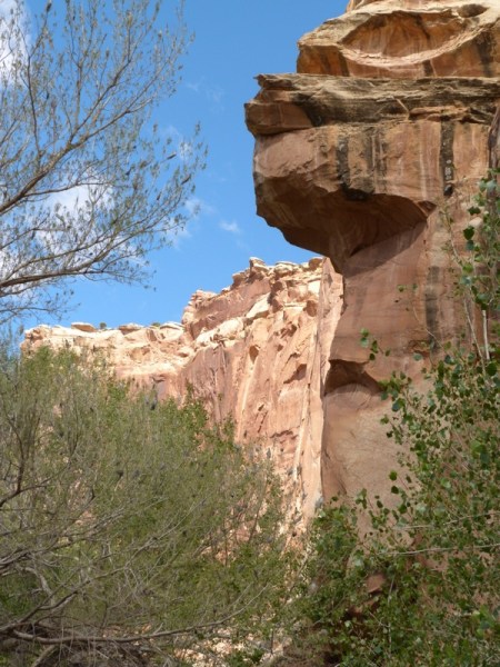
Can you see why I am considering this another of the best days? I love happy surprises, and this day is full of happy surprises, even a few flakes of short-lived snow.


Good thing we stopped where we did. Just another quarter of a mile down the road is a major stop, with a beautiful walkway, so people can view Petroglyphs!
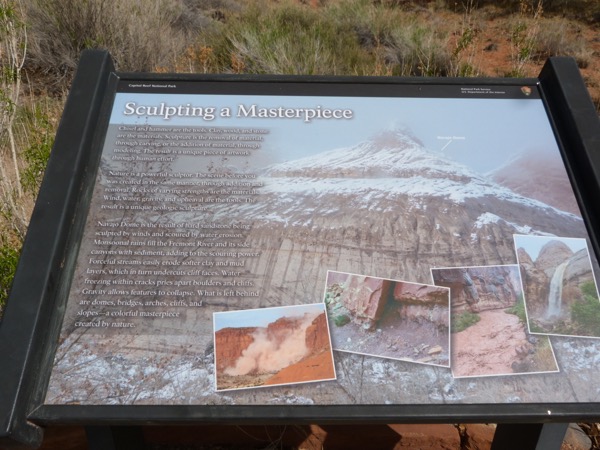
So, can you see the petroglyphs? I bet your eyes are getting better at it. You learn to look a little higher than you would think.


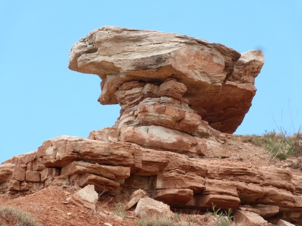
There are so many places where petroglyphs have been lost to natural breaking off and erosion.


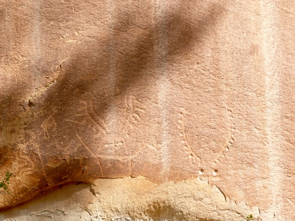

This is a piece that has broken off, but remnants of the original petroglyphs remain.

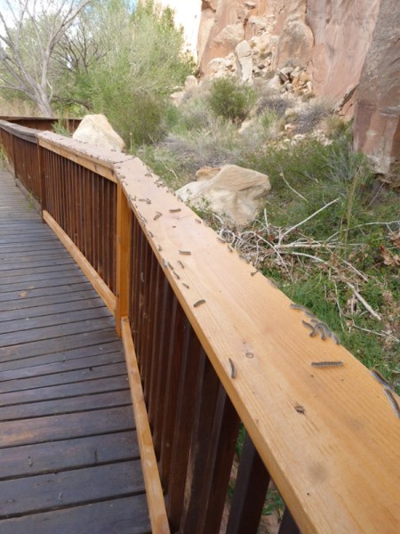
This is the beautiful walkway they built.

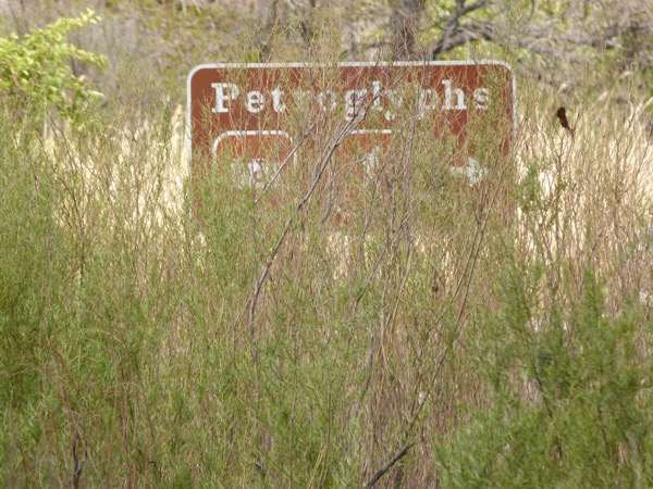
This is the sign. It is a little obscured, but we are always thankful for good signage.
I want you to know how very brave I was. I was about to lean on the railing to steady a shot when AdventureMan said “You’ll want to look before you do that,” and when I did, I saw a thousand creeping caterpillars. They were falling out of the trees, and covered the walkway. I made AdventureMan check my hair, and my hoodie, then I covered my hair completely; I looked like a total dork. Back in the car, I made him check me again, to make sure I wasn’t carrying an unwelcome guest with me. But no matter how much I was creeped out, it didn’t stop me from taking these photos 🙂
“This is the day that the Lord has made! Let us rejoice and be thankful in it!”
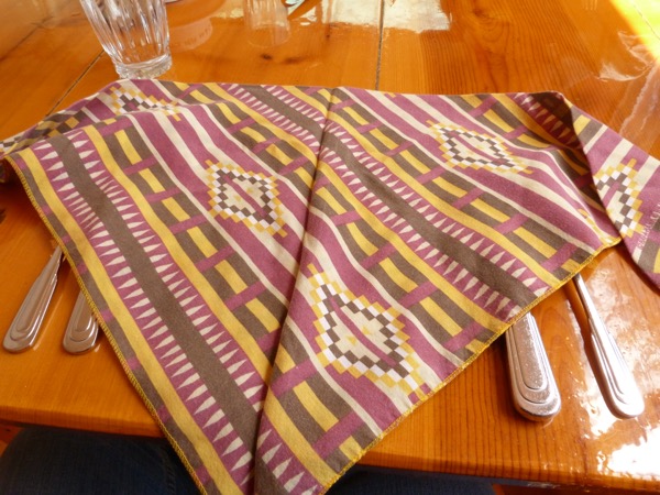
Shortly after finding a gas station, and looking for a restaurant that was open and might serve more than hamburgers and beer, we found the Capitol Reefs Cafe and Restaurant, which suited us perfectly. It had a unique gift store – I found the only petroglyph soap, black with etched petroglyphs – of the entire trip, perfect for a three year old, or even in the tip of AdventureMan’s Christmas stocking. Alas, there was only one, and I gave it to the three year old.


Look at that! Cloth napkins, and in a beautiful local textile.
AdventureMan had a fabulous corn chowder, and these Shrimp Tostadas.

I had a smoked trout salad, the only one I have ever had in my life. It was unique, and wonderful.

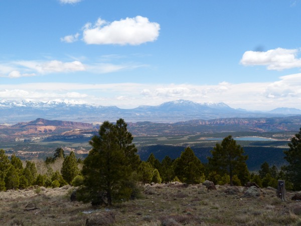
At Larb Hollow overlook, you could see for miles, maybe hundreds of miles. We could see Lake Powell. In the highlands, it was still very cold, and we had occasional flakes of snow.


This stop was hilarious. We thought it was some kind of big deal but it was a very little deal. It reminded us very much of Germany, with a rural forest feel, a walk around a large lake, people with those walking picks that give me the shivers – “No! Don’t point that pick at me!”

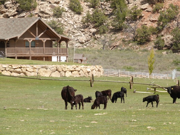
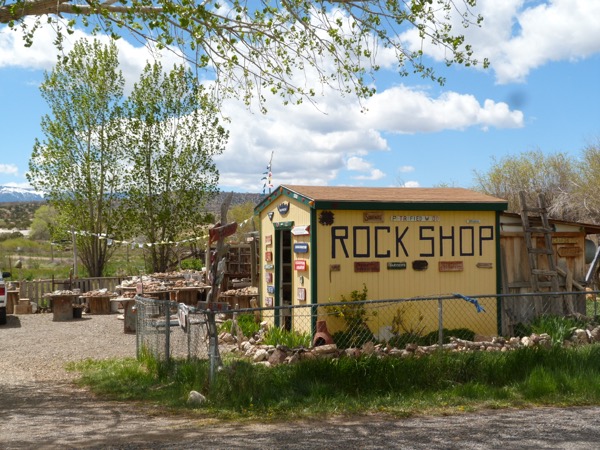
We stopped at a rock shop, where I bought a T-shirt I loved. He said it was last year’s color, and gave me a great discount, but it was a much more subtle color, a desert deep rose color, and it has a 70’s peace sign in gold, so elaborate that you don’t necessarily even see what it is. I love it. Then I went to take a photo of these cows, which AdventureMan thought was hilarious. “You’d be surprised how many people stop to take photos of those cows,” the owner of The Rock Shop told him.

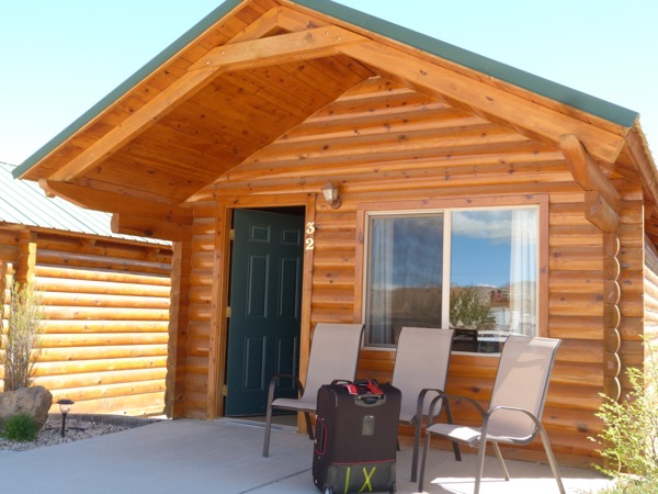
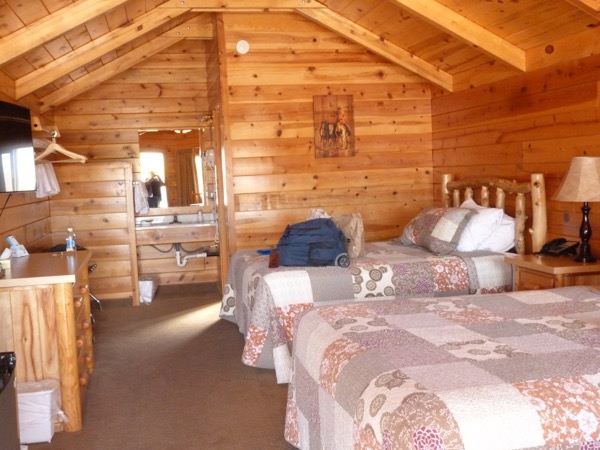
Arriving in Tropic, we are assigned to this cabin. Of all the places we stayed on the trip, we loved this cabin the best. It was a lot of fun, spacious, clean, very private, great beds, and the least expensive place we stayed. This was the Bryce Canyon Inn, in Tropic, which also has a coffee shop and a pizza restaurant in the same complex.

We took a short rest, then headed out to do a reconnaissance of Bryce Canyon, finding one of the major sights on our way. I think it was called Mossy Grotto, or something like that. Honestly, they give names to all these hikes, and while the hikes are great, I can’t remember the exact names. These are all late in the day, some times the sunlight is perfect and some times it has already disappeared due to landscape features. We needed a good hike after spending so much of the day with our only exercise getting in and out of the car.


This is one of the features, and I couldn’t really figure out why. I think in winter it has huge icicles hanging from it. It is moist and water weeps from it. I think it is the mossy grotto.

It looks like these rocks are kissing 🙂

We headed back to Tropic around dinner time, ate at the pizza restaurant. AdventureMan did the smart thing, he ordered a pizza. I saw halibut and chips on the menu and the Alaska-girl instincts kicked in, oh, halibut and chips! I got two small heavily breaded pre-frozen little lumps of fish, tasteless, what a waste of halibut. 😦 Learned – re-learned a lesson: if you’re in a pizza restaurant, order pizza.
We slept wonderfully in this cabin 🙂 Every day so far exceeds 10,000 steps 🙂
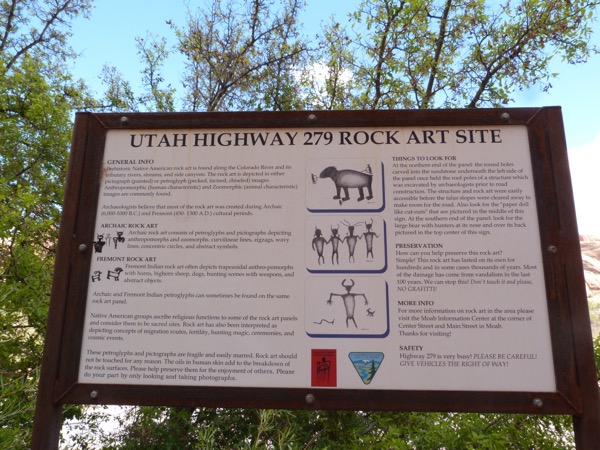
Potash Road and Pictographs, Moab, Utah
Potash road is 279; you can see where it begins near the entrance to Arches National Park, but on the other side of the main road as you are going towards Moab. It is clearly marked Potash Road.
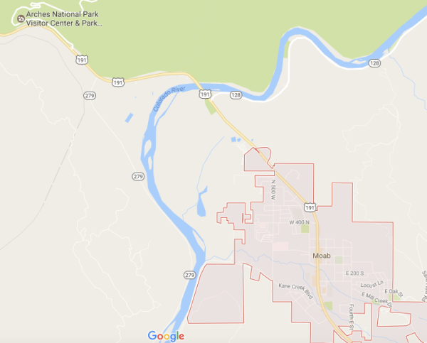
After our long hike, and our fabulous lunch, we took a short nap, then headed out to find ancient petroglyphs and pictographs. (Pictographs are painted on, petroglyphs are incised out.) Potash Road was near the entrance to Arches National park. It looked like an ordinary road, even a farm road. Once again, a road that started out looking and sounding inauspicious turned out to be a lot of fun.
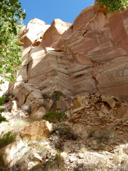
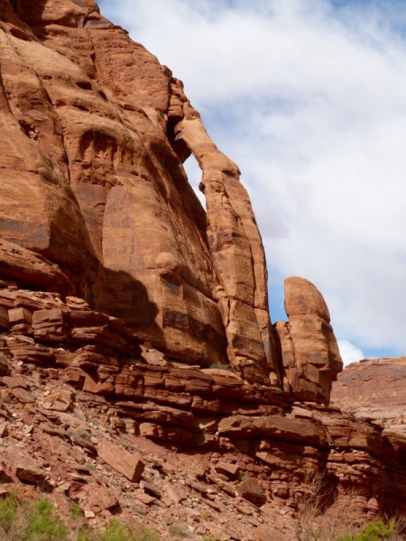
First, the road follows the Colorado River flowing along swiftly, full of rafters and boaters. Then you come to the cliffs about 5 miles in which are used by the climbing and rappelling schools to teach rock climbing, and there must have been fifty separate people working their way up and down the cliffs. This is not for the weak in body; we saw one dazed and damaged young man being loaded into an emergency vehicle for transport back to the hospital. Just past the rock climbers is the first set of petroglyphs, which are really hard to spot, about 20 feet off the ground, but once you get the hang of it, you start spotting them everywhere.
The truth is, I can hardly ever spot them. AdventureMan has sharp eyes, he spots them and shows me where they are. This time, they are about 15 feet, 20 feet above the road. They were incised when the Colorado River, at our backs, was higher, before it eroded the valley more deeply.
Can you see any pictographs?


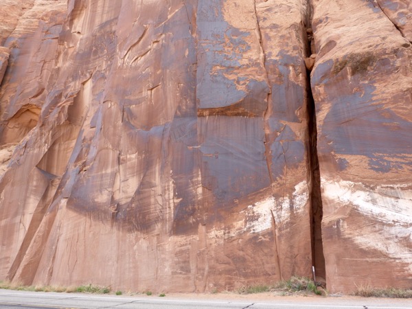
I can begin to see these; AdventureMan shows me where they are.

These are the cliffs where the rock climbing classes are held and the pictographs co-exist with the rock climbing.

Now, they are beginning to be more clear.
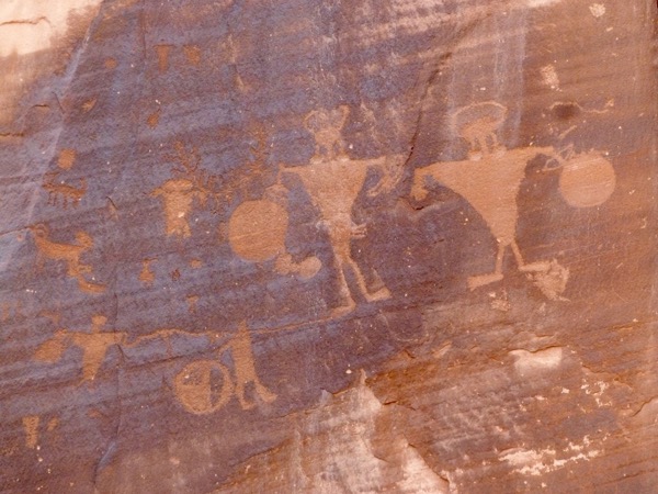


This is what the casual observer sees:

If you see closely, you can find some petroglyphs.


This is near the end of Potash Road, looking back into Canyonlands, toward the Dead Horse Point.

The Colorado River parallels Potash Road, which is in the foreground.

This is the climb up to the dinosaur track. I got this far, and the next part of the hike was straight up. It’s late in the day, my legs are shaky, I am not going to climb straight up and risk falling straight down.

This is the dinosaur print. AdventureMan climbed all the way up!


Potash Road was a total thrill. It is easy to miss the sign for the Dinosaur Track if you are coming from Moab. We got all the way past the Potash Plant to the beginning of the unpaved, unimproved road before we turned around, and only on the way back did we spot the sign showing where the dinosaur track was. It was not a well marked trail, in fact, it was barely a trail at all, and I thought it was dangerous.
Petroglyphs in the Petrified Forest
So here we segue back to the Petrified Forest, and it may not seem logical in a linear, chronological sense, like time-as-pearls-strung-together-on-a-string sort of thing, but in terms of like things, the next chronological entry is going to be on 700 years of culture, the Ancestral Puebloans who used to be called the Anasazi, but before I go there, I want to show you some petroglyphs.
(I’m putting in a lot of links in case you are as big a petroglyph nerd as I am, and want to read more)
I always imagine the problems with being early man. Imagine they are smart, and spend a lot of their days figuring things out, most important being 1. What are we going to eat? 2. How are we going to keep dry/warm? 3. How do we protect ourselves from our enemies? They have the same problems we have, only on a much more basic level, and with fewer resources.
Have you ever thought about how easy it is to get information now? (The hard part being sifting through so you get the most reliable, most relevant information). Imagine a world where you have to figure it out for yourself, every day.
Early civilizations fascinate me. I am always interested in little tiny things that can be very important, like how did they fasten skins together to keep themselves warm? How do you poke a hole in a sharp bone so you can use it as a needle? How do you make a button, or make strips that can be used to tie clothing together?
How do you fasten a spear head onto a spear, or an arrowhead onto an arrow?
Early man was a problem solver, and I am fascinated by petroglyphs, which are either early attempts at documentation, or early attempts at communication, or maybe both? The first petroglyphs and cave paintings I ever visited were the Font de Gaume Caves near Les Eyzies-de-Tayac-Sireuil, and they took my breath away. I didn’t even hesitate because it was a cave, I wanted to see them so badly.
I want you to look at this photo of a fairly early dwelling in Les Eyzies de Tayac-Sireuil and hold it in your mind before we move on:

Later, living in Saudi Arabia, one of the most fun day trips ever was to a rock formation called Graffiti Rock, which had no protection, so very old petroglyphs mingled with modern carvings, but some of the older carvings were so interesting, so intriguing.
Coming across petroglyphs in the Petrified Forest was a delight.
Here is part of what the national parks website has to say about petroglyphs found in the Petrified Forest:
In 1977 a spiral petroglyph at Chaco Canyon National Monument was discovered which displayed a precise interaction with sunlight at the time of summer solstice by means of a narrow shaft of sunlight that moved down a shadowed rock face to bisect the center of a large spiral petroglyph. Subsequent observations found that on winter solstice and equinoxes there were intriguing interactions of sunlit shafts with the large spiral and a smaller spiral nearby. No other example of a sunlight interaction with prehistoric or historic petroglyphs was known at this time. However, there was a tradition of Pueblo sun watching in historic times, particularly of the varying sunrise and sunset positions throughout the year, to set the dates for ceremonies.
As a result of the Chaco Canyon find, Bob Preston initiated a research project to determine whether other petroglyph sites in the Southwest functioned as solar “observatories.” Over the last 16 years he has identified about 120 examples of similar solstice events at more than 50 petroglyph sites in Arizona, New Mexico and southern Utah. Evidence indicates that the phenomenon may have been spread over as much as a 1000-km region. These findings show clearly that certain petroglyphs were used by early pueblo cultures to function as calendrical markers for the winter and summer solstices. Petrified Forest National Park contains the greatest known concentration of solar calendars, with 16 of the sites being in or immediately adjacent to the park, and has been key to understanding their nature.
Shadows and sunlit images are found to move across petroglyphs due to other rocks being in the path of the sun’s rays. As the sun’s path across the sky changes throughout the year, the positions of the shadows and sunlit images change on the petroglyph panels. In many cases the petroglyphs have been placed on the rock faces in just the right position so that specific interactions occur on the solstices. The most common types of petroglyphs on which solsitial interactions have been identified are spirals and circles. The key to determining that these were intended and not by chance is that interactions are seen from site to site, and occur on the solstices more frequently than on other days of the year. These consistent interactions may involve a point of sunlight or shadow piercing the center or tracing the edge of a spiral or circular petroglyph; or shadow lines may suddenly appear or disappear at the center or edges of the petroglyph; or they may move up to the center or edge and then retreat. It is not uncommon for a single petroglyph to display multiple interactions of this type, either on the same solstice or on each of the solstices. In fact, at one site, there are five circular and spiral petroglyphs that show 15 interactions on the both solstices.
An intriguing question is whether types of petroglyph images were involved with specific dates. In several cases similar sunlight and shadow interactions occur on spiral and circular petroglyphs on the equinox, and distinctive interactions occur with other petroglyphs on the solstices and other dates. Clearly much of the puzzle remains to be unraveled.
There was a WEALTH of petroglyphs. I’m just going to show you a few of those we found:
This one makes me laugh; it looks so much like our modern day stork-who-brings-babies (LOL, where did that legend/story start anyway??)


LOL, these feet are larger than life, or else they were made by giants!


Early people in widely separated parts of the world carved and painted on rock, probably for a number of reasons, maybe keeping track of solar activity and seasons, maybe magical/religious thinking for a good hunt or nostalgia for a good hunt, maybe just someone who, like today’s blogger, just has to document in some way . . . 😉
Recent Comments
ExpatAlien on What Country am I Living … intlxpatr on Yellowstone: Old Faithful to C… Michelle on Yellowstone: Old Faithful to C… Cathy on No Grown-Ups in Charge intlxpatr on Waiting for Snow Wikipedia Donate Button

Amazina

Early Voting in Florida


