New From Google Book Search!
You know, big guys make me nervous. Sometimes, they get a monopoly, and throw their weight around, making you and me pay more for less and less service.
Not Google.
I love Google. I love Google searches, I love GoogleEarth, and oh man, I love Google Book Search. And this is so totally cool – look what they are coming up with now!
Google Book Search in Google Earth
Monday, August 20, 2007 at 11:54 AM
Posted by Brandon Badger, Product Manager
Did you ever wonder what Lewis and Clark said about your hometown as they passed through? What about if any other historical figures wrote about your part of the world? Earlier this year, we announced a first step toward geomapping the world’s literary information by starting to integrate information from Google Book Search into Google Maps. Today, the Google Book Search and Google Earth teams are excited to announce the next step: a new layer in Earth that allows you to explore locations through the lens of the world’s books.
Now when you turn on the “Google Book Search” layer in Google Earth (found in the “Featured Content” folder in the “Layers” menu), you’ll see small book icons scattered around the globe. When you click on one of the book icons, a pop-up balloon will display a snippet of text from one of Book Search’s public domain books that references that location. You’ll also find links to the Google Book Search page for that snippet so that you can learn more about what it has to say about the city or town.
For example, let’s say that you’re interested in Detroit, Michigan.
You can find out more by clicking here.
Have fun!
(Sorry, can’t write more! Have to go do some book searches! Thanks, Earthling!)
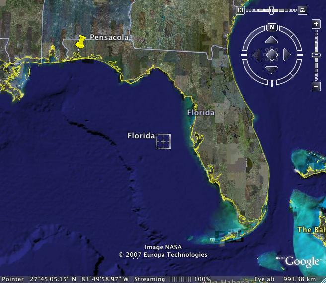
Where is Pensacola, FL?
It isn’t only my Kuwaiti friends . . . . many of my American friends don’t know where Pensacola is, either.
Pensacola is almost in Alabama.
You can see it at the far left of the map. It has a big bay, and a barrier island with a gorgeous, white sand beach. It is fairly unspoiled, as Florida goes, with more moderate temperatures, and some slight shift in seasons.
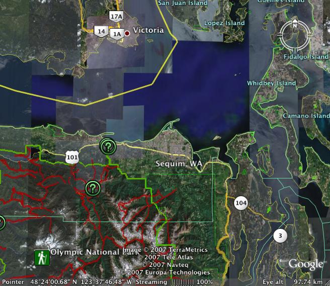
Sequim and Dungeness on Google
I know you guys explained in detail how to post maps. I know you even used small words, easy words, but somehow, I can’t make it work your way. I guess I need a workshop or something.
But I CAN go on GoogleEarth and SaveImage. It works for me, and I can use it here to share with you where the prior photos are taken on the trip to Sequim and Dungeness.
This is the map of the Sequim/Dungeness area. Dungeness is the spit up at the top where some of the sweetest crabs in the world live and die to feed our hearts and souls. If you ever get a chance to drive on the Olympic Peninsula, you will want to do so. It is not crowded, and the scenery is totally awe inspiring. There are Indian reservations selling Indian art, fields and fields of lavender, fresh fruits and vegetables, farms of all kinds, and views of the Puget Sound. Even in rainy weather, it is gloriously beautiful.

Here you can see Sequim and the Dungeness Spit as part of the larger area:
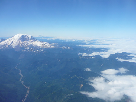
Five Mountains
Every now and then flying into Seattle you can see a whole line of mountains, from Mt. Rainier to Mt. Hood, the remains of Mt. St. Helens, Mt. Adams and sometimes, way off in the distance, Mt. Shasta.
I think you can see three easily in this photo; Mt. Rainier in the center, one to the left and one to the right.
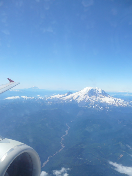
East of the mountains, it is totally clear. West of the mountains, there is cloud cover:
My car is waiting, my bags are off the plane first – is my travel karma back? I don’t dare count on it, but I’m thankful for all travel mercies.
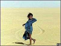
World’s Largest Camel Race
BBC has published photos from the World’s Largest Camel Race, 468 camels in Layonne, Western Sahara.

Wikipedia says:
Western Sahara (Arabic: الصحراء الغربية; transliterated: al-Ṣaḥrā’ al-Gharbīyah; Spanish: Sahara Occidental) is a territory of northwestern Africa, bordered by Morocco to the north, Algeria in the northeast, Mauritania to the east and south, and the Atlantic Ocean on the west. It is one of the most sparsely populated territories in the world, mainly consisting of desert flatlands. The largest city is El Aaiún (Laâyoune), which is home to over half of the population of the territory.

7 Million Muslims
In today’s Kuwait Times is an Independance Day message from the American Ambassador, Richard LeBaron, in which he states:
Numbering some seven million, there are more Muslims in America than in Kuwait, Bahrain, Qatar and the UAE combined. In our more than 1,200 mosques that stand peacefully alongside churches and synagogues, you will find congregations as diverse as America itself. . .
I had no idea. I know in the Seattle area there are many mosques, many Moslems; Seattle is a city built on the energy and hope of new immigrants. But I had no idea we had seven million Moslems in the USA.
If you want to read the full text of the message you will have to buy the paper – it’s not on the website.
Desertification
UN issues desertification warning
By Matt McGrath
BBC environment reporter
Tens of millions of people could be driven from their homes by encroaching deserts, particularly in sub-Saharan Africa and Central Asia, a report says.
The study by the United Nations University suggests climate change is making desertification “the greatest environmental challenge of our times”.
If action is not taken, the report warns that some 50 million people could be displaced within the next 10 years.
The study was produced by more than 200 experts from 25 countries.
Scarce resources
This report does not pull any punches – desertification is an environmental crisis of global proportions, it says, and one third of the Earth’s population are potential victims of its creeping effect.
This is just an excerpt from an article you can read in full at BBN News.
Gulf History Source
Thank you, Kinan, for bringing this website to our attention yesterday on the Kuwait boats blog entry. I had been to the site before, while looking up information on Gulf Architecture. The blogger writes from a particularly Qatar point of view, but what he learns and documents applies greatly to all the countries along west side of the Arabian Gulf. And I am adding him to my blogroll.
I love this man’s attention to detail. I have lifted a photo from his page on Arab Gulf boats. This is the typical toilet on the bigger old boats. It is called a zuli. Ugh!
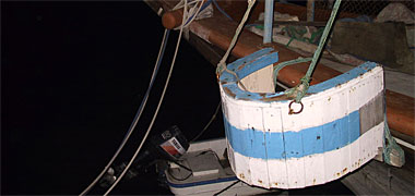
The website is catnaps.org and if you click here, it will take you to his fascinating and fairly thorough website on Arabian Gulf boats. If you click here, you will find a long article on Gulf Architecture but he has an entirely separate entry for Islamic Architecture. It is not easy reading, but it is not something you will be tested on at the end of the hour, either. It’s just a great opportunity to learn more about a subject you never considered.
On his About page, the author tells us his name is John Lockerbie and:
In addition to working in the areas of project management, architecture, planning and urban design I have taught architecture, graphic design and presentation. I have had a wide scale of design involvement ranging from the exciting design worlds of crockery, cutlery, glass and napery, rising in scale through other aspects of graphic, interior, architectural and urban design to strategic planning. I have also been lucky enough to have worked in change management and primary education.
On a hot, lazy day when you have nothing better to do, you can spend a couple hours getting lost on his website, and come away a more knowledgable person for having done so.
Again, thank you Kinan, for a truly GREAT weblink.
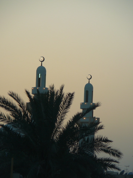
Kuwait Beauty
“If you but have the eyes to see . . .”
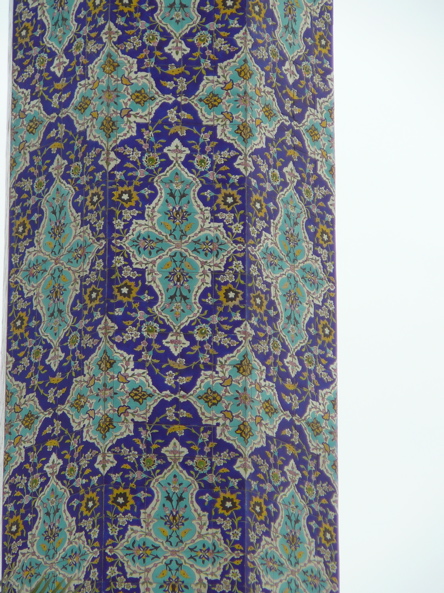
There is great beauty in Kuwait. Here is the spire of a mosque I found in Hawalli when I got lost. (Yes, people look at me like I am out of my mind when I stop and take photos of these things they see everyday.)
Here is detail from the spire:
Here is an old-fashioned meshrabiyya window at the home standing over the Tarek Rajab Museum. Who can believe that such a museum treasure is open to the public for free, thanks to the graciousness of a private family, who sees the beauty in the Gulf Heritage, collects and preserves it.

Here is the globe near the entrance to Kuwait University, reminding us always that we are all connected in this world:

Dusk is my favorite time in Kuwait – the glare of the sun softens, and the colors glow:
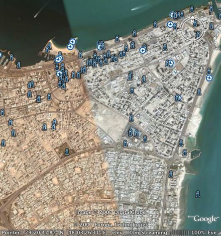
GoogleEarth – Make Your Own Maps
You, too, can make your own maps, and get where you need to go, thanks to GoogleEarth. If you are a landmark driver, like me, this will make your day.
A friend gave me a map to her house that blew my mind – it was a GoogleEarth map, with lines and arrows and landmarks – everything I need when I am driving. I could see the roundabouts! I could see the major landmarks! I knew EXACTLY where to turn, which mosque where I would turn right, and which field to drive across.
She said her husband had done it; she didn’t know how. I opened GoogleEarth and figured it out. Now – oh my! I have maps to everywhere! It is so totally cool!
You open Google, find EXACTLY the image you need to use for your map (be sure your major landmarks are in the frame) and you go to File on the toolbar and scroll down to Save – there is an arrow, and you choose Save Image.
You open your drawing program – in my case, Appleworks, but it will work with your drawing program, too.
You paste your map into your drawing program, and then you add your arrows showing the route to take, and you add text identifying the landmarks, and perhaps writing out the directions.
And then you print. It’s that easy. And holy smokes, the maps are totally usable.
Recent Comments
ExpatAlien on What Country am I Living … intlxpatr on Yellowstone: Old Faithful to C… Michelle on Yellowstone: Old Faithful to C… Cathy on No Grown-Ups in Charge intlxpatr on Waiting for Snow Wikipedia Donate Button

Amazina

Early Voting in Florida


